IMAGES TAKEN NEAR TO
Chelford Road, KNUTSFORD, WA16 8RD
Introduction
This page details the photographs taken nearby to Chelford Road, WA16 8RD by members of the Geograph project.
The Geograph project started in 2005 with the aim of publishing, organising and preserving representative images for every square kilometre of Great Britain, Ireland and the Isle of Man.

There are currently over 7.5m images from over14,400 individuals and you can help contribute to the project by visiting https://www.geograph.org.uk
Image Map
Images are licensed for reuse under creativecommons.org/licenses/by-sa/2.0
Notes
- Clicking on the map will re-center to the selected point.
- The higher the marker number, the further away the image location is from the centre of the postcode.
Image Listing (13 Images Found)
Images are licensed for reuse under creativecommons.org/licenses/by-sa/2.0
Image
Details
Distance
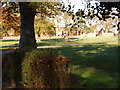
1
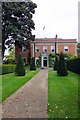
Kerfield House
Despite its Hanoverian appearance this building was built just before WW1 see http://cheshireeast-consult.limehouse.co.uk/portal/planning/spd/locallist?pointId=1299169990199
Image: © Glyn Baker
Taken: 21 Sep 2013
0.06 miles
2
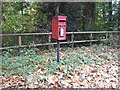
Elizabeth II postbox on Chelford Road (A537)
Image: © JThomas
Taken: 29 Oct 2016
0.07 miles
3
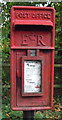
Close up, Elizabeth II postbox on Chelford Road (A537)
Postbox No. WA16 44.
See Image] for wider view.
Image: © JThomas
Taken: 29 Oct 2016
0.07 miles
4
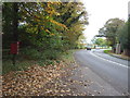
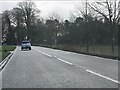
Chelford Road (A537)
Looking west showing position of Postbox No. WA16 44.
See Image] for postbox.
Image: © JThomas
Taken: 29 Oct 2016
0.07 miles
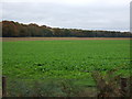
6
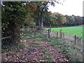
Track beside Windmill Wood
Off Chelford Road.
Image: © JThomas
Taken: 29 Oct 2016
0.09 miles
8
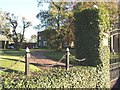
Kerfield House
On the A537 SW of Knutsford. A difficult one to pin point on the map,(is it top right of SJ7676 or top left of 7776 ??)
Image: © Ian Warburton
Taken: 25 Nov 2005
0.12 miles
10
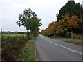
Ollerton Grange
About 1/2km west of Dun Cow Inn on A537
Image: © Ian Warburton
Taken: 25 Nov 2005
0.20 miles