IMAGES TAKEN NEAR TO
Higher Downs, KNUTSFORD, WA16 8AW
Introduction
This page details the photographs taken nearby to Higher Downs, WA16 8AW by members of the Geograph project.
The Geograph project started in 2005 with the aim of publishing, organising and preserving representative images for every square kilometre of Great Britain, Ireland and the Isle of Man.

There are currently over 7.5m images from over14,400 individuals and you can help contribute to the project by visiting https://www.geograph.org.uk
Image Map
Images are licensed for reuse under creativecommons.org/licenses/by-sa/2.0
Notes
- Clicking on the map will re-center to the selected point.
- The higher the marker number, the further away the image location is from the centre of the postcode.
Image Listing (10 Images Found)
Images are licensed for reuse under creativecommons.org/licenses/by-sa/2.0
Image
Details
Distance
1
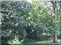
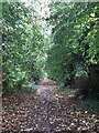
Forest Area St Vincent's Primary School
Image: © Geography Club 2017
Taken: 14 Jun 2017
0.10 miles
2
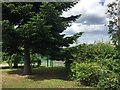
Forest Area St Vincent's Primary School
Image: © Geography Club 2017
Taken: 14 Jun 2017
0.10 miles
5
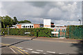
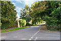
Manor Park School and Nursery, Knutsford
Image: © David Dixon
Taken: 5 Sep 2020
0.14 miles
10
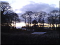
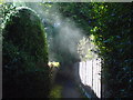
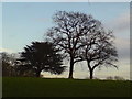
View across the allotments on Sparrow Lane
Image: © Schlosser67
Taken: 28 Jan 2011
0.23 miles