IMAGES TAKEN NEAR TO
Burleyhurst Lane, KNUTSFORD, WA16 7LR
Introduction
This page details the photographs taken nearby to Burleyhurst Lane, WA16 7LR by members of the Geograph project.
The Geograph project started in 2005 with the aim of publishing, organising and preserving representative images for every square kilometre of Great Britain, Ireland and the Isle of Man.

There are currently over 7.5m images from over14,400 individuals and you can help contribute to the project by visiting https://www.geograph.org.uk
Image Map
Images are licensed for reuse under creativecommons.org/licenses/by-sa/2.0
Notes
- Clicking on the map will re-center to the selected point.
- The higher the marker number, the further away the image location is from the centre of the postcode.
Image Listing (10 Images Found)
Images are licensed for reuse under creativecommons.org/licenses/by-sa/2.0
Image
Details
Distance
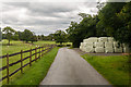
4
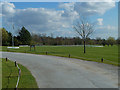
Entrance to Mobberley Golf Club, Cheshire
Image: © Anthony O'Neil
Taken: 22 Mar 2011
0.15 miles
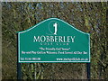
5
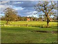
Hollingee Farm
Entrance to Hollingee Farm.
Image: © Peter McDermott
Taken: 16 Aug 2014
0.15 miles
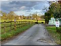
8
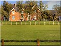
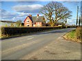
Sunny Side Farm, Burleyhurst Lane, Mobberley, Cheshire
change title
Image: © Anthony O'Neil
Taken: 22 Mar 2011
0.19 miles
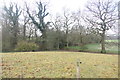
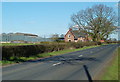
10

Unused gate and stile on Burleyhurst Lane
Image: © Graham Hogg
Taken: 5 Dec 2017
0.22 miles