IMAGES TAKEN NEAR TO
Mowpen Brow, KNUTSFORD, WA16 6PB
Introduction
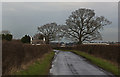
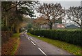
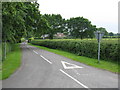
This page details the photographs taken nearby to Mowpen Brow, WA16 6PB by members of the Geograph project.
The Geograph project started in 2005 with the aim of publishing, organising and preserving representative images for every square kilometre of Great Britain, Ireland and the Isle of Man.

There are currently over 7.5m images from over14,400 individuals and you can help contribute to the project by visiting https://www.geograph.org.uk
Image Map
Images are licensed for reuse under creativecommons.org/licenses/by-sa/2.0
Notes
- Clicking on the map will re-center to the selected point.
- The higher the marker number, the further away the image location is from the centre of the postcode.
Image Listing (6 Images Found)
Images are licensed for reuse under creativecommons.org/licenses/by-sa/2.0
Image
Details
Distance
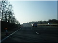
2
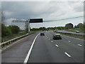
The M56 east towards Manchester
Nets are placed under the powerlines that cross the motorway while repairs are done to the lines.
Image: © Ian S
Taken: 22 Apr 2012
0.16 miles