IMAGES TAKEN NEAR TO
Chester Road, KNUTSFORD, WA16 0TZ
Introduction
This page details the photographs taken nearby to Chester Road, WA16 0TZ by members of the Geograph project.
The Geograph project started in 2005 with the aim of publishing, organising and preserving representative images for every square kilometre of Great Britain, Ireland and the Isle of Man.

There are currently over 7.5m images from over14,400 individuals and you can help contribute to the project by visiting https://www.geograph.org.uk
Image Map
Images are licensed for reuse under creativecommons.org/licenses/by-sa/2.0
Notes
- Clicking on the map will re-center to the selected point.
- The higher the marker number, the further away the image location is from the centre of the postcode.
Image Listing (22 Images Found)
Images are licensed for reuse under creativecommons.org/licenses/by-sa/2.0
Image
Details
Distance
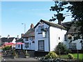
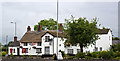
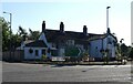
9
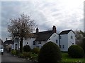
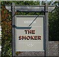
The Smoker Inn
Named after the nearby Smoker Brook. Originally built in C17. See http://www.britishlistedbuildings.co.uk/en-58550-the-smoker-inn-plumley-#.VUp8mvlViko for entry in British Listed Buildings.
Image: © Bikeboy
Taken: 16 Apr 2015
0.12 miles
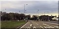
10
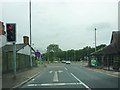
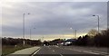
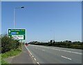
Junction of Plumley Moor Road with the A556
Image: © Alexander P Kapp
Taken: 28 Jul 2011
0.12 miles