IMAGES TAKEN NEAR TO
Ashley Road, ALTRINCHAM, WA15 9SQ

Introduction

This page details the photographs taken nearby to Ashley Road, WA15 9SQ by members of the Geograph project.

The Geograph project started in 2005 with the aim of publishing, organising and preserving representative images for every square kilometre of Great Britain, Ireland and the Isle of Man.

There are currently over 7.5m images from over14,400 individuals and you can help contribute to the project by visiting https://www.geograph.org.uk

Image Map


Images are licensed for reuse under creativecommons.org/licenses/by-sa/2.0
Notes
  • Clicking on the map will re-center to the selected point.
  • The higher the marker number, the further away the image location is from the centre of the postcode.

Image Listing (168 Images Found)

Images are licensed for reuse under creativecommons.org/licenses/by-sa/2.0
  • ...
Image
Details
Distance
1
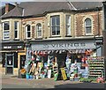
Village hardware
Ashley Road, Hale
Image: © Anthony O'Neil Taken: 26 Apr 2021
0.00 miles
2
Hale celebrates (7)
Image: © Anthony O'Neil Taken: 7 May 2023
0.01 miles
3
Hale celebrates (6)
Image: © Anthony O'Neil Taken: 7 May 2023
0.01 miles
4
Hale celebrates (4)
Ashley Road
Image: © Anthony O'Neil Taken: 7 May 2023
0.02 miles
5
Hale celebrates (9)
Street food
Image: © Anthony O'Neil Taken: 7 May 2023
0.02 miles
6
Modern Art gallery
Hale village
Image: © Anthony O'Neil Taken: 26 Apr 2021
0.02 miles
7
Ashley Road, Hale, in the 1980s
Main street of Hale village (viewed from near the station). Note the welcome absence of parked cars - a considerable difference from the scene today. In earlier centuries - until the arrival of the railway from Altrincham (circa 1862) - the area now called Hale village was virtually a marsh. Underlying clay prevented streams, from the high ground of Bowdon, from draining away. When the railway boom encouraged shops to develop along Ashley Road, ditches and culverts were dug behind the shops and cottages to carry the waters towards Bowdon Vale and thence into the River Bollin. Even in the 1950s, nearby Hale Cinema - now demolished - had water pumps operating continuously in the basement, to prevent flooding.
Image: © Anthony O'Neil Taken: Unknown
0.02 miles
8
View of Ashley Road, Hale
This is taken from the edge of the Bowling Green. The prominent monkey-puzzle tree has been a feature here since well before WW2. Ahead is the Ashley Hotel which was built on the site of the old Drill Hall and Hale Urban District Council offices. Apart from that instance of demolition and rebuilding, the village overall has remained largely unaltered since the War. The most intrusive change, here as elsewhere, has been the continued increase in traffic and nose-to-tail parking.
Image: © Anthony O'Neil Taken: Unknown
0.02 miles
9
Shopping in Hale (5)
Opticians
Image: © Anthony O'Neil Taken: 21 Feb 2023
0.02 miles
10
Ashley Road
Hale Village
Image: © Anthony O'Neil Taken: 20 Aug 2022
0.02 miles
  • ...