IMAGES TAKEN NEAR TO
Woodlea, ALTRINCHAM, WA15 8WH
Introduction
This page details the photographs taken nearby to Woodlea, WA15 8WH by members of the Geograph project.
The Geograph project started in 2005 with the aim of publishing, organising and preserving representative images for every square kilometre of Great Britain, Ireland and the Isle of Man.

There are currently over 7.5m images from over14,400 individuals and you can help contribute to the project by visiting https://www.geograph.org.uk
Image Map
Images are licensed for reuse under creativecommons.org/licenses/by-sa/2.0
Notes
- Clicking on the map will re-center to the selected point.
- The higher the marker number, the further away the image location is from the centre of the postcode.
Image Listing (20 Images Found)
Images are licensed for reuse under creativecommons.org/licenses/by-sa/2.0
Image
Details
Distance
1
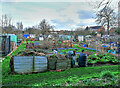
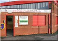
Allotments
Adjacent to Altrincham football ground
Image: © Anthony O'Neil
Taken: 25 Feb 2024
0.10 miles
2
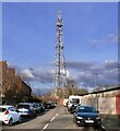
Radio Mast
Golf Road - adjacent to Altrincham Football Ground
Image: © Anthony O'Neil
Taken: 25 Feb 2024
0.10 miles
3
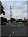
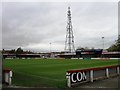
Communications tower
The communications tower is situated at the end of Golf Road, close to Altrincham Football Ground (on the right).
Image: © Richard Sutcliffe
Taken: 19 Jun 2015
0.10 miles
5
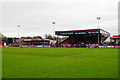
Football match at the J Davidson Stadium
A cup tie between Altrincham and Ramsbottom Utd.
Image: © Bill Boaden
Taken: 11 Nov 2017
0.16 miles
6
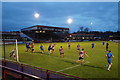
Football match at the J Davidson Stadium
A cup tie between Altrincham and Ramsbottom Utd.
Image: © Bill Boaden
Taken: 11 Nov 2017
0.16 miles
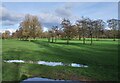
8
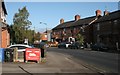
Moss Lane, Hale
Just to the west of Altrincham Football Club's ground.
Image: © Richard Sutcliffe
Taken: 10 Oct 2016
0.18 miles
9
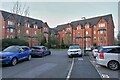
Change of use
Most of the residents of Copper Moss will not know that their property lies on the site of the 1837 Altrincham Gas Works, which remained in use well after WWII. Coal wagons, from a storage depot at Altrincham Station, used to run along adjacent Moss Lane, on a branch line, to supply the plant with fuel.
When the Works was finally demolished, heavy trucks spent months removing contaminated top soil before new construction could begin.
Image: © Anthony O'Neil
Taken: 25 Feb 2024
0.18 miles