IMAGES TAKEN NEAR TO
Rossmill Lane, ALTRINCHAM, WA15 0EU
Introduction
This page details the photographs taken nearby to Rossmill Lane, WA15 0EU by members of the Geograph project.
The Geograph project started in 2005 with the aim of publishing, organising and preserving representative images for every square kilometre of Great Britain, Ireland and the Isle of Man.

There are currently over 7.5m images from over14,400 individuals and you can help contribute to the project by visiting https://www.geograph.org.uk
Image Map
Images are licensed for reuse under creativecommons.org/licenses/by-sa/2.0
Notes
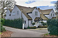
- Clicking on the map will re-center to the selected point.
- The higher the marker number, the further away the image location is from the centre of the postcode.
Image Listing (24 Images Found)
Images are licensed for reuse under creativecommons.org/licenses/by-sa/2.0
Image
Details
Distance
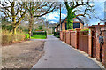
5
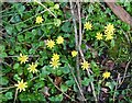
Around Hale Barns (13)
Spring springing
Image: © Anthony O'Neil
Taken: 24 Mar 2022
0.12 miles
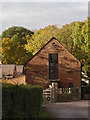
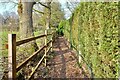
8
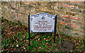
Rossmill
So says the sign on the gate which leads into the Bollin Valley walk.
Image: © Ian Paterson
Taken: 16 Mar 2011
0.14 miles
9
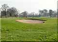
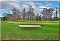
Around Hale Barns (14)
Fairway - Hale Golf Course
Image: © Anthony O'Neil
Taken: 24 Mar 2022
0.16 miles
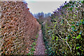
10
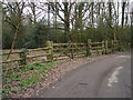
Around Hale Barns (12)
Towards Barroow Lane
Image: © Anthony O'Neil
Taken: 24 Mar 2022
0.16 miles