IMAGES TAKEN NEAR TO
Cherry Tree Lane, ALTRINCHAM, WA14 3QW
Introduction
This page details the photographs taken nearby to Cherry Tree Lane, WA14 3QW by members of the Geograph project.
The Geograph project started in 2005 with the aim of publishing, organising and preserving representative images for every square kilometre of Great Britain, Ireland and the Isle of Man.

There are currently over 7.5m images from over14,400 individuals and you can help contribute to the project by visiting https://www.geograph.org.uk
Image Map
Images are licensed for reuse under creativecommons.org/licenses/by-sa/2.0
Notes
- Clicking on the map will re-center to the selected point.
- The higher the marker number, the further away the image location is from the centre of the postcode.
Image Listing (22 Images Found)
Images are licensed for reuse under creativecommons.org/licenses/by-sa/2.0
Image
Details
Distance
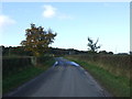
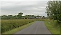
3
Briddon Weir Farm
Photographed from Cherry Tree Lane.
Image: © Peter Whatley
Taken: 27 Feb 2009
0.02 miles
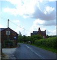
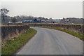
4
View of Briddon Weir Farm from the adjacent road
Image: © Anthony O'Neil
Taken: 19 Jun 2010
0.02 miles
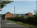
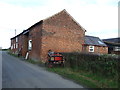
7
Briddon Weir Farm, near Rostherne, Cheshire
Image: © Anthony O'Neil
Taken: 19 Jun 2010
0.03 miles
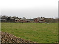
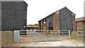
8
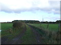
Farm track near Briddon Water Farm
Off Cherry Tree Lane.
Image: © JThomas
Taken: 5 Nov 2016
0.10 miles