IMAGES TAKEN NEAR TO
Courtney Place, ALTRINCHAM, WA14 3QT
Introduction
This page details the photographs taken nearby to Courtney Place, WA14 3QT by members of the Geograph project.
The Geograph project started in 2005 with the aim of publishing, organising and preserving representative images for every square kilometre of Great Britain, Ireland and the Isle of Man.

There are currently over 7.5m images from over14,400 individuals and you can help contribute to the project by visiting https://www.geograph.org.uk
Image Map
Images are licensed for reuse under creativecommons.org/licenses/by-sa/2.0
Notes
- Clicking on the map will re-center to the selected point.
- The higher the marker number, the further away the image location is from the centre of the postcode.
Image Listing (12 Images Found)
Images are licensed for reuse under creativecommons.org/licenses/by-sa/2.0
Image
Details
Distance
1
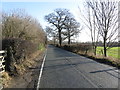
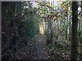
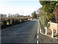
Bow Green Road
A typical lane in Manchester's southern outer suburbs.
Image: © Peter Whatley
Taken: 20 Jan 2009
0.06 miles
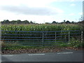
4
Flower stall in lay-by by A56, Bowdon
A sales outlet for a flower grower
Image: © David Smith
Taken: 24 Oct 2019
0.19 miles
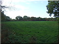
6
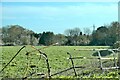
Farmland and wood
South of Bow Green Road
Image: © Anthony O'Neil
Taken: 25 Apr 2021
0.19 miles
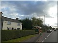
10
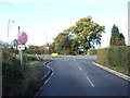
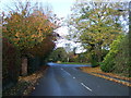
Junction on Bow Green Road (B5161)
Joining the A56.
Image: © JThomas
Taken: 5 Nov 2016
0.21 miles