IMAGES TAKEN NEAR TO
Ashley Mill Lane, ALTRINCHAM, WA14 3PY
Introduction
This page details the photographs taken nearby to Ashley Mill Lane, WA14 3PY by members of the Geograph project.
The Geograph project started in 2005 with the aim of publishing, organising and preserving representative images for every square kilometre of Great Britain, Ireland and the Isle of Man.

There are currently over 7.5m images from over14,400 individuals and you can help contribute to the project by visiting https://www.geograph.org.uk
Image Map
Images are licensed for reuse under creativecommons.org/licenses/by-sa/2.0
Notes
- Clicking on the map will re-center to the selected point.
- The higher the marker number, the further away the image location is from the centre of the postcode.
Image Listing (30 Images Found)
Images are licensed for reuse under creativecommons.org/licenses/by-sa/2.0
Image
Details
Distance
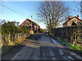
2
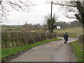
Ashley Road
Ashley Road, near Coppice Farm.
Image: © David Dixon
Taken: 16 Jan 2012
0.02 miles
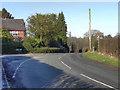
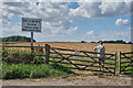
4
Ashley Mill Lane
The road to Ashley Mill; it seems like they discourage visitors!
Image: © David Dixon
Taken: 16 Jan 2012
0.08 miles
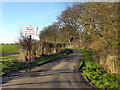
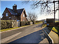
7
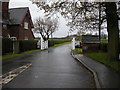
North Lodge, Ashley Hall
There are new gates, compared with this photograph [http://www.geograph.org.uk/photo/2767230] taken in 2012.
Image: © Richard Sutcliffe
Taken: 24 Apr 2016
0.11 miles
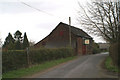
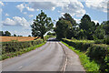
10
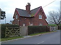
Ashley Hall Lodge near Ashley Heath, Cheshire
Image: © Anthony O'Neil
Taken: 25 Mar 2011
0.13 miles