IMAGES TAKEN NEAR TO
Bow Lane, ALTRINCHAM, WA14 3BY
Introduction
This page details the photographs taken nearby to Bow Lane, WA14 3BY by members of the Geograph project.
The Geograph project started in 2005 with the aim of publishing, organising and preserving representative images for every square kilometre of Great Britain, Ireland and the Isle of Man.

There are currently over 7.5m images from over14,400 individuals and you can help contribute to the project by visiting https://www.geograph.org.uk
Image Map
Images are licensed for reuse under creativecommons.org/licenses/by-sa/2.0
Notes
- Clicking on the map will re-center to the selected point.
- The higher the marker number, the further away the image location is from the centre of the postcode.
Image Listing (17 Images Found)
Images are licensed for reuse under creativecommons.org/licenses/by-sa/2.0
Image
Details
Distance
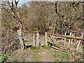
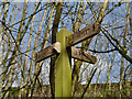
2
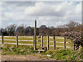
Fence, Stile and Signpost, Bollin Valley Way
Stile near Pool Bank Farm.
Image: © David Dixon
Taken: 16 Apr 2013
0.02 miles
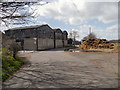
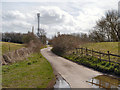
4
Track between Bowgreen and Pool Bank Farms
Image: © David Dixon
Taken: 16 Apr 2013
0.06 miles
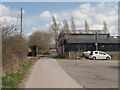
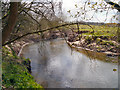
5
Track at Castle Hill
The path/track from Pool Bank Farm continues towards the Bowdon Water Treatment Works.
Image: © David Dixon
Taken: 16 Apr 2013
0.09 miles
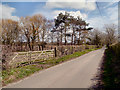
10
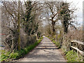
Track near Bowgreen Farm
Tree-lined path fromBowgreen Farm towards Pool Bank Farm.
Image: © David Dixon
Taken: 16 Apr 2013
0.16 miles