1
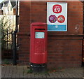
Corner of Vicarage Lane and Priory Road
The road in front leads to allotments. The tower of St Mary's Church is on the horizon.
Image: © Richard Sutcliffe
Taken: 27 Mar 2017
0.01 miles
2
St Luke's Church,Vicarage Lane, Bowdon
Originally built as the Vale Mission Room in the late 1800s or early 1900s, it later became St Luke’s Church.
Image: © Richard Sutcliffe
Taken: 27 Mar 2017
0.06 miles
3
Postbox, Vicarage Lane Post Office
The postbox (number WA14 23) is situated just outside the Post Office, which is in the Co-op store on Vicarage Lane.
Image: © Richard Sutcliffe
Taken: 27 Mar 2017
0.08 miles
4
Co-op store, Bowdon Vale
Now a Co-op store (and incorporating a post office), it was originally built as an infants school on land given by the Stamford family. The foundation stone, laid by the Countess of Stamford, can still be seen on the side of the building [http://www.geograph.org.uk/photo/5329959].
Image: © Richard Sutcliffe
Taken: 27 Mar 2017
0.09 miles
5
Co-operative food store and Post Office
On Vicarage Lane.
Showing position of Postbox No. WA14 23.
See
Image] for postbox.
Image: © JThomas
Taken: 5 Nov 2016
0.09 miles
6
Elizabeth II postbox on Vicarage Lane
Outside Post Office.
Postbox No. WA14 23.
See
Image] for context.
Image: © JThomas
Taken: 5 Nov 2016
0.09 miles
7
Foundation stone for former infants school, Bowdon Vale
Foundation stone for the infants school, which was built on land given by the Stamford family.
The inscription reads:
A.M.D.C.
This stone was laid by
Penelope
Countess of Stamford
April 28th 1909
The building is now a Co-op store [http://www.geograph.org.uk/photo/5329903].
Image: © Richard Sutcliffe
Taken: 27 Mar 2017
0.09 miles
8
Co-op, Bowdon Vale
This ornate canopy, dated 1909, seems very out of place on a Co-op store. The reason is that the building was originally built as an infants school on land given by the Stamford family. The foundation stone, laid by the Countess of Stamford, can be seen at the bottom [http://www.geograph.org.uk/photo/5329959].
Image: © Richard Sutcliffe
Taken: 27 Mar 2017
0.09 miles
9
Path to the Methodist church
The path leads from Priory Road to the Bowdon Vale Methodist Church, on Priory Street.
Image: © Richard Sutcliffe
Taken: 26 Mar 2017
0.11 miles
10
Priory Road
Image: © Richard Sutcliffe
Taken: 26 Mar 2017
0.15 miles


