IMAGES TAKEN NEAR TO
Woodville Road, ALTRINCHAM, WA14 2HD
Introduction
This page details the photographs taken nearby to Woodville Road, WA14 2HD by members of the Geograph project.
The Geograph project started in 2005 with the aim of publishing, organising and preserving representative images for every square kilometre of Great Britain, Ireland and the Isle of Man.

There are currently over 7.5m images from over14,400 individuals and you can help contribute to the project by visiting https://www.geograph.org.uk
Image Map
Images are licensed for reuse under creativecommons.org/licenses/by-sa/2.0
Notes
- Clicking on the map will re-center to the selected point.
- The higher the marker number, the further away the image location is from the centre of the postcode.
Image Listing (64 Images Found)
Images are licensed for reuse under creativecommons.org/licenses/by-sa/2.0
Image
Details
Distance
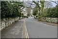
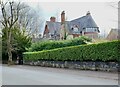
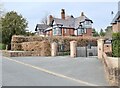
3
Around Bowdon (9)
"Chasewood', Woodville Road
Image: © Anthony O'Neil
Taken: 27 Mar 2022
0.05 miles
4
Around Bowdon (6)
'Westlind', Woodville Road
Image: © Anthony O'Neil
Taken: 27 Mar 2022
0.06 miles
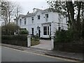
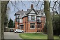
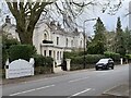
5
Around Bowdon (4)
'Moreton House', St Margaret's Road
Image: © Anthony O'Neil
Taken: 27 Mar 2022
0.06 miles
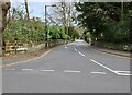
6
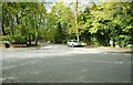
Junction of St Margaret's Road and Groby Road
Image: © Richard Sutcliffe
Taken: 23 Apr 2017
0.06 miles
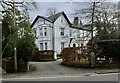
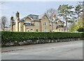
7
Around Bowdon (18)
'Stramore', Woodville Road
Image: © Anthony O'Neil
Taken: 27 Mar 2022
0.07 miles
8
Around Bowdon (5)
'Westwood', St Margaret's Road
Image: © Anthony O'Neil
Taken: 27 Mar 2022
0.08 miles
9
Around Bowdon (11)
'Canagh', Woodville Road
Image: © Anthony O'Neil
Taken: 27 Mar 2022
0.08 miles
10
Around Bowdon (21)
'North Woodville', St Margaret's Road
Image: © Anthony O'Neil
Taken: 27 Mar 2022
0.08 miles