IMAGES TAKEN NEAR TO
Ellesmere Road, ALTRINCHAM, WA14 1JQ

Introduction

This page details the photographs taken nearby to Ellesmere Road, WA14 1JQ by members of the Geograph project.

The Geograph project started in 2005 with the aim of publishing, organising and preserving representative images for every square kilometre of Great Britain, Ireland and the Isle of Man.

There are currently over 7.5m images from over14,400 individuals and you can help contribute to the project by visiting https://www.geograph.org.uk

Image Map


Images are licensed for reuse under creativecommons.org/licenses/by-sa/2.0
Notes
  • Clicking on the map will re-center to the selected point.
  • The higher the marker number, the further away the image location is from the centre of the postcode.

Image Listing (31 Images Found)

Images are licensed for reuse under creativecommons.org/licenses/by-sa/2.0
  • ...
Image
Details
Distance
1
Navigation Road signalbox
Closed as part of the resignalling scheme associated with downgrading the Manchester-Altrincham route to a tram line in 1992/93.
Image: © Peter Whatley Taken: 25 Jun 1988
0.13 miles
2
Navigation Road Level Crossing
Image: © David Dixon Taken: 11 Mar 2010
0.13 miles
3
Navigation Road crossing
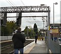
A tram crosses the Navigation Road level crossing (Image]) as it approaches Navigation Road station.
Image: © David Dixon Taken: 11 Mar 2010
0.13 miles
4
Navigation Road station
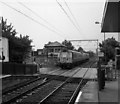
Car 1017 is about to enter the station on its way to Piccadilly
Image: © Dr Neil Clifton Taken: 23 Aug 1993
0.13 miles
5
Navigation Road
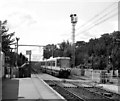
A Down train, receding from the camera on its way to Altrincham, is about to clear the Navigation Road level crossing
Image: © Dr Neil Clifton Taken: 1 Jun 1990
0.13 miles
6
Tram coming into Navigation Road Metrolink Station
It requires the level crossing to close Wellington Road.
Image: © Bill Boaden Taken: 2 May 2015
0.13 miles
7
Navigation Primary School
An odd name for an inland site, especially with the school badge having a nautical theme. However the name of the locality stems from its links with the canal.
Image: © Bill Boaden Taken: 2 May 2015
0.14 miles
8
Navigation Road
The last stop on the Metrolink tram line before Altrincham. On this section the tram lines run alongside the main railway line and so there is a platform on one side only creating a brief bottleneck. Immediately outside the station is a level crossing.
Image: © Gerald England Taken: 20 Sep 2011
0.14 miles
9
Navigation Road Station
Image: © David Dixon Taken: 11 Mar 2010
0.14 miles
10
Be quick!
Navigation Road station level crossing: a man sprints for the train to Manchester. He's probably too occupied to notice the classic 1960s station design and typography.
Image: © Peter Whatley Taken: 25 Jun 1988
0.15 miles
  • ...