IMAGES TAKEN NEAR TO
Albany Road, LYMM, WA13 9LP

Introduction

This page details the photographs taken nearby to Albany Road, WA13 9LP by members of the Geograph project.

The Geograph project started in 2005 with the aim of publishing, organising and preserving representative images for every square kilometre of Great Britain, Ireland and the Isle of Man.

There are currently over 7.5m images from over14,400 individuals and you can help contribute to the project by visiting https://www.geograph.org.uk

Image Map


Images are licensed for reuse under creativecommons.org/licenses/by-sa/2.0
Notes
  • Clicking on the map will re-center to the selected point.
  • The higher the marker number, the further away the image location is from the centre of the postcode.

Image Listing (28 Images Found)

Images are licensed for reuse under creativecommons.org/licenses/by-sa/2.0
  • ...
Image
Details
Distance
1
Site of Lymm Station
Closed to passengers in 1962, the railway continued as a freight line until 1985. Now a rails to trails conversion giving a traffic free route between Warrington and Altrincham. The closure was probably precipitated by the need to renovate the Latchford Viaduct. At that time one of the Stupid's big ideas was an ideological loathing of railways. Even the Forth Bridge (same engineers, Arrols) was considered for closure.
Image: © Richard Webb Taken: 11 Aug 2019
0.08 miles
2
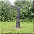
Millennium milepost, Lymm
On route 62, a former railway line.
Image: © Richard Webb Taken: 11 Aug 2019
0.10 miles
3
Trans Pennine Trail at Whitbarrow Road
Image: © Anthony O'Neil Taken: 11 Nov 2012
0.11 miles
4
Bridgewater Canal towards Ditchfields Bridge
Image: © Ian S Taken: 1 Mar 2022
0.12 miles
5
Entrance to Meadow View Fisheries
Three commercially developed fishing pools stocked and maintained with a variety of popular fish species.
Image: © Anthony O'Neil Taken: 16 Nov 2012
0.12 miles
6
Trans Pennine Trail, Lymm
Closed to passengers in 1962, the railway continued as a freight line until 1985. Now a rails to trails conversion giving a traffic free route between Warrington and Altrincham. The closure was probably precipitated by the need to renovate the Latchford Viaduct. At that time one of the Stupid's big ideas was an ideological loathing of railways. Even the Forth Bridge (same engineers, Arrols) was considered for closure.
Image: © Richard Webb Taken: 11 Aug 2019
0.13 miles
7
Bridgewater Canal
The Bridgewater Canal in Lymm.
Image: © Peter McDermott Taken: 2 Apr 2021
0.14 miles
8
This didn't get away ! !
This little blighter (our biggest of the day) was caught by my 12yr old son at this fishery. It is one of several different types of carp stocked here.
Image: © Dave Smethurst Taken: 29 Aug 2005
0.15 miles
9
Bridgewater Canal towards Ditchfields Bridge
Image: © Ian S Taken: 1 Mar 2022
0.15 miles
10
Government plaque at Meadow View Fisheries
Image: © Anthony O'Neil Taken: 16 Nov 2012
0.15 miles
  • ...