IMAGES TAKEN NEAR TO
Howard Avenue, LYMM, WA13 9EH
Introduction
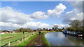
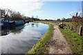
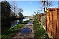
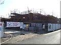
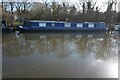
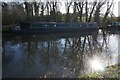
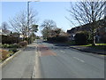
This page details the photographs taken nearby to Howard Avenue, WA13 9EH by members of the Geograph project.
The Geograph project started in 2005 with the aim of publishing, organising and preserving representative images for every square kilometre of Great Britain, Ireland and the Isle of Man.

There are currently over 7.5m images from over14,400 individuals and you can help contribute to the project by visiting https://www.geograph.org.uk
Image Map
Images are licensed for reuse under creativecommons.org/licenses/by-sa/2.0
Notes
- Clicking on the map will re-center to the selected point.
- The higher the marker number, the further away the image location is from the centre of the postcode.
Image Listing (32 Images Found)
Images are licensed for reuse under creativecommons.org/licenses/by-sa/2.0
Image
Details
Distance
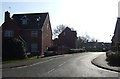
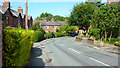
3
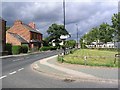
A6144
This photo shows the A6144 as it heads past the Farmers Arms towards the disused railway. The turning on the right leads to Oughtrington. The shot was taken from the junction at SJ696881.
Image: © Dave Smethurst
Taken: 20 Jul 2005
0.15 miles