IMAGES TAKEN NEAR TO
Brook Road, LYMM, WA13 9AH
Introduction
This page details the photographs taken nearby to Brook Road, WA13 9AH by members of the Geograph project.
The Geograph project started in 2005 with the aim of publishing, organising and preserving representative images for every square kilometre of Great Britain, Ireland and the Isle of Man.

There are currently over 7.5m images from over14,400 individuals and you can help contribute to the project by visiting https://www.geograph.org.uk
Image Map
Images are licensed for reuse under creativecommons.org/licenses/by-sa/2.0
Notes
- Clicking on the map will re-center to the selected point.
- The higher the marker number, the further away the image location is from the centre of the postcode.
Image Listing (78 Images Found)
Images are licensed for reuse under creativecommons.org/licenses/by-sa/2.0
Image
Details
Distance
2
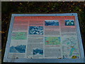
Information Board - Trans Pennine Trail
On the site of the former Lymm Station, marking the time when this path was the route of the Warrington - Altrincham railway (1851-1985).
Image: © Anthony O'Neil
Taken: 11 Nov 2012
0.06 miles
3
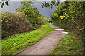
Trans Pennine Trail at Whitbarrow Road
Image: © Anthony O'Neil
Taken: 11 Nov 2012
0.09 miles
4
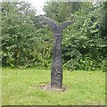
Millennium milepost, Lymm
On route 62, a former railway line.
Image: © Richard Webb
Taken: 11 Aug 2019
0.10 miles
5
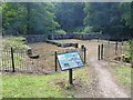
Lymm Slitting Mill
Restored remains of a "slitting mill", used to produce narrow strips of metal, used in (e.g.) nailmaking. Opened by 1751, it was abandoned by 1825 and excavated by industrial archaeologists in the 1970s and again in 2005. Described as "the best surviving example of a slitting mill in the country".
Image: © Dave Dunford
Taken: 30 Jul 2015
0.10 miles
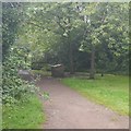
6
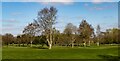
'Life for a Life' Lymm Memorial Forest
Image: © Richard Cooke
Taken: 30 Dec 2012
0.11 miles
9
Site of Lymm Station
Closed to passengers in 1962, the railway continued as a freight line until 1985. Now a rails to trails conversion giving a traffic free route between Warrington and Altrincham.
The closure was probably precipitated by the need to renovate the Latchford Viaduct. At that time one of the Stupid's big ideas was an ideological loathing of railways. Even the Forth Bridge (same engineers, Arrols) was considered for closure.
Image: © Richard Webb
Taken: 11 Aug 2019
0.12 miles
10
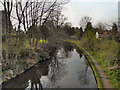
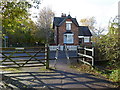
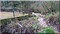
Bridgewater Canal, Lymm
Looking west from the bridge at Brookfield Road.
Image: © David Dixon
Taken: 22 Mar 2012
0.12 miles