IMAGES TAKEN NEAR TO
Bradlegh Road, NEWTON-LE-WILLOWS, WA12 8RB
Introduction
This page details the photographs taken nearby to Bradlegh Road, WA12 8RB by members of the Geograph project.
The Geograph project started in 2005 with the aim of publishing, organising and preserving representative images for every square kilometre of Great Britain, Ireland and the Isle of Man.

There are currently over 7.5m images from over14,400 individuals and you can help contribute to the project by visiting https://www.geograph.org.uk
Image Map
Images are licensed for reuse under creativecommons.org/licenses/by-sa/2.0
Notes
- Clicking on the map will re-center to the selected point.
- The higher the marker number, the further away the image location is from the centre of the postcode.
Image Listing (34 Images Found)
Images are licensed for reuse under creativecommons.org/licenses/by-sa/2.0
Image
Details
Distance
5
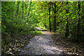
Path in Red Brow Wood
Leading to the Sankey Canal
Image: © Gary Rogers
Taken: 10 Oct 2017
0.07 miles
6
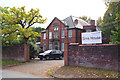
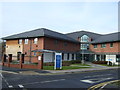
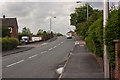
Sims House, Bradley Road, Newton Le Willows
NHS Halton and St Helens Primary Care Trust
Image: © Gary Rogers
Taken: 10 Oct 2017
0.10 miles
9
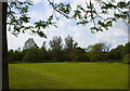
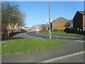
Green space on the fringe of the linear park
Image: © Ian Greig
Taken: 9 May 2011
0.15 miles