IMAGES TAKEN NEAR TO
East Lancashire Road, NEWTON-LE-WILLOWS, WA12 0HL
Introduction
This page details the photographs taken nearby to East Lancashire Road, WA12 0HL by members of the Geograph project.
The Geograph project started in 2005 with the aim of publishing, organising and preserving representative images for every square kilometre of Great Britain, Ireland and the Isle of Man.

There are currently over 7.5m images from over14,400 individuals and you can help contribute to the project by visiting https://www.geograph.org.uk
Image Map
Images are licensed for reuse under creativecommons.org/licenses/by-sa/2.0
Notes
- Clicking on the map will re-center to the selected point.
- The higher the marker number, the further away the image location is from the centre of the postcode.
Image Listing (34 Images Found)
Images are licensed for reuse under creativecommons.org/licenses/by-sa/2.0
Image
Details
Distance
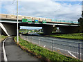
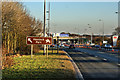
1
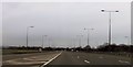
Haydock Park roundabout: north-west corner
Part of the roundabout junction between M6, A580 and A49. The roundabout features lane-spiralling to manoeuvre vehicles across the road toward their exit, plus a through route at grade for the A580.
Image: © Peter Whatley
Taken: 24 Mar 2011
0.04 miles
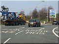
2
Haydock Island
Junction between the M6 (J23), A580 East Lancs Road and the A49
Image: © Richard Cooke
Taken: 11 Oct 2009
0.07 miles
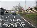
4
A580 East Lancs Road from M6 northbound
M6 junction 23
Image: © John Firth
Taken: 9 May 2011
0.09 miles
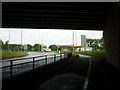
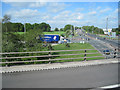
5
M6/A580/A49 interchange, Haydock Park
Even before the advent of the M6 on July 2nd, 1963, this was a most important road junction. Here, the principal north-south route through Lancashire (A49) met the East Lancashire Road (A580), one of the great road building projects of the 1920s and 30s. Opened in 1934, the "East Lancs Road" was the pre-motorway equivalent of the M62 and arguably of more significance in economic terms for the cities of Liverpool and Manchester. More details of the A580 can be viewed here: http://www.lancashire.gov.uk/environment/historichighways/eastlancs/index.asp
The size of the M6 viaduct is difficult to capture due to contemporary levels of traffic at the junction, but this view gives some idea. The intersection was one of the first motorway roundabout junctions to have a through route added at grade for the secondary road - in this case the A580.
Image: © Peter Whatley
Taken: 24 Mar 2011
0.09 miles
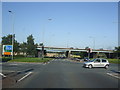
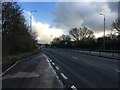
8
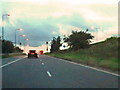
M6, Junction 23 Slip Road
The slip road from the East Lancashire Road (A580) to the northbound M6 at Junction 23.
Image: © David Dixon
Taken: 17 Sep 2010
0.09 miles