IMAGES TAKEN NEAR TO
Pimbo Lane, ST. HELENS, WA11 8RG
Introduction
This page details the photographs taken nearby to Pimbo Lane, WA11 8RG by members of the Geograph project.
The Geograph project started in 2005 with the aim of publishing, organising and preserving representative images for every square kilometre of Great Britain, Ireland and the Isle of Man.

There are currently over 7.5m images from over14,400 individuals and you can help contribute to the project by visiting https://www.geograph.org.uk
Image Map
Images are licensed for reuse under creativecommons.org/licenses/by-sa/2.0
Notes
- Clicking on the map will re-center to the selected point.
- The higher the marker number, the further away the image location is from the centre of the postcode.
Image Listing (24 Images Found)
Images are licensed for reuse under creativecommons.org/licenses/by-sa/2.0
Image
Details
Distance
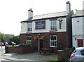
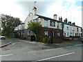
10
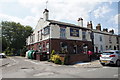
Collier's Arms, Kings Moss, between Rainford and Billinge
Image: © Mike Pennington
Taken: 24 Jul 2014
0.12 miles