IMAGES TAKEN NEAR TO
Higher Lane, ST. HELENS, WA11 8NH
Introduction
This page details the photographs taken nearby to Higher Lane, WA11 8NH by members of the Geograph project.
The Geograph project started in 2005 with the aim of publishing, organising and preserving representative images for every square kilometre of Great Britain, Ireland and the Isle of Man.

There are currently over 7.5m images from over14,400 individuals and you can help contribute to the project by visiting https://www.geograph.org.uk
Image Map
Images are licensed for reuse under creativecommons.org/licenses/by-sa/2.0
Notes
- Clicking on the map will re-center to the selected point.
- The higher the marker number, the further away the image location is from the centre of the postcode.
Image Listing (21 Images Found)
Images are licensed for reuse under creativecommons.org/licenses/by-sa/2.0
Image
Details
Distance
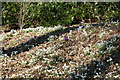
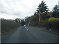
7
Industrial Estate at Rainford
View from the road at SD492001 southwest across a waterlogged field to the industrial estate in SJ4899 at Rainford.
Image: © Gary Rogers
Taken: 18 Jan 2006
0.12 miles
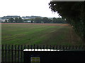
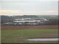
8
Field between Rainford Industrial Estate and Higher Lane
Image: © Gary Rogers
Taken: 26 Feb 2016
0.15 miles
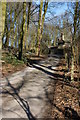
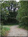
9
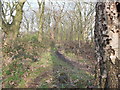
Path between Rainford Industrial Estate and Higher Lane
Through a narrow strip of woodland.
Image: © Gary Rogers
Taken: 26 Feb 2016
0.18 miles
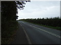
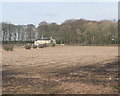
10
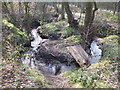
Stream between Higher Lane and Rainford Industrial Estate
The stream runs through a narrow strip of woodland
Image: © Gary Rogers
Taken: 26 Feb 2016
0.18 miles