IMAGES TAKEN NEAR TO
Standish Drive, ST. HELENS, WA11 8JY
Introduction
This page details the photographs taken nearby to Standish Drive, WA11 8JY by members of the Geograph project.
The Geograph project started in 2005 with the aim of publishing, organising and preserving representative images for every square kilometre of Great Britain, Ireland and the Isle of Man.

There are currently over 7.5m images from over14,400 individuals and you can help contribute to the project by visiting https://www.geograph.org.uk
Image Map
Images are licensed for reuse under creativecommons.org/licenses/by-sa/2.0
Notes
- Clicking on the map will re-center to the selected point.
- The higher the marker number, the further away the image location is from the centre of the postcode.
Image Listing (6 Images Found)
Images are licensed for reuse under creativecommons.org/licenses/by-sa/2.0
Image
Details
Distance
2
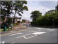
Old Lane roundabout Rainford
Rainford Brook passes beneath the road at this point
Image: © Raymond Knapman
Taken: 15 Aug 2010
0.20 miles

5
Rainford Linear Park, Entrance East of Old Lane
The railway line between St Helens and Rainford Junction finally closed in 1964, when the lines north of Mill Lane were lifted. Much of the railway's route through Rainford has been converted to a 'linear park'. Effectively a footpath and cycleway.
Image: © David Dixon
Taken: 28 Oct 2019
0.22 miles
6

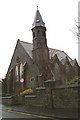
The Old Schoolhouse
The Old Schoolhouse in Victoria Street.
Image: © Sue Adair
Taken: 1 May 2013
0.24 miles