IMAGES TAKEN NEAR TO
Crank Road, ST. HELENS, WA11 7RZ
Introduction
This page details the photographs taken nearby to Crank Road, WA11 7RZ by members of the Geograph project.
The Geograph project started in 2005 with the aim of publishing, organising and preserving representative images for every square kilometre of Great Britain, Ireland and the Isle of Man.

There are currently over 7.5m images from over14,400 individuals and you can help contribute to the project by visiting https://www.geograph.org.uk
Image Map
Images are licensed for reuse under creativecommons.org/licenses/by-sa/2.0
Notes
- Clicking on the map will re-center to the selected point.
- The higher the marker number, the further away the image location is from the centre of the postcode.
Image Listing (25 Images Found)
Images are licensed for reuse under creativecommons.org/licenses/by-sa/2.0
Image
Details
Distance
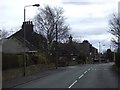
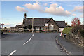
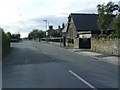
2
Crank Road (B5201)
Heading north east into Crank.
Image: © JThomas
Taken: 13 Sep 2014
0.03 miles
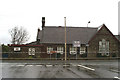
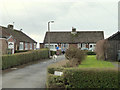
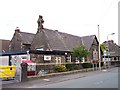
6
Crank Day Nursery
Crank is a village near Rainford in the Metropolitan Borough of St Helens. This is a view looking northwards along Crank Road. The building at the top is the Crank Day Nursery.
Image: © David Dixon
Taken: 28 Oct 2019
0.06 miles
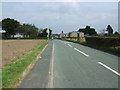
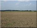
7
Crank Hill
Crank is a village near Rainford in the Metropolitan Borough of St Helens.
Image: © David Dixon
Taken: 28 Oct 2019
0.06 miles
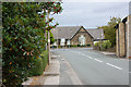
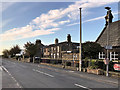
9
Crank Nursery at junction with Crank Road
Image: © Raymond Knapman
Taken: 16 Jul 2010
0.07 miles