IMAGES TAKEN NEAR TO
Hall Road, ST. HELENS, WA11 0PG
Introduction
This page details the photographs taken nearby to Hall Road, WA11 0PG by members of the Geograph project.
The Geograph project started in 2005 with the aim of publishing, organising and preserving representative images for every square kilometre of Great Britain, Ireland and the Isle of Man.

There are currently over 7.5m images from over14,400 individuals and you can help contribute to the project by visiting https://www.geograph.org.uk
Image Map
Images are licensed for reuse under creativecommons.org/licenses/by-sa/2.0
Notes
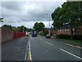
- Clicking on the map will re-center to the selected point.
- The higher the marker number, the further away the image location is from the centre of the postcode.
Image Listing (36 Images Found)
Images are licensed for reuse under creativecommons.org/licenses/by-sa/2.0
Image
Details
Distance
3
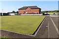
Bowling green, Haydock
On the grounds of Haydock Cricket Club.
Image: © Bob Embleton
Taken: 26 Aug 2013
0.12 miles
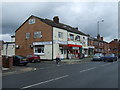
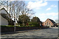
4

Post Office and Shops - Church Road, Haydock
Image: © Anthony Parkes
Taken: 24 Feb 2016
0.12 miles
6
St James' Parish Church & Parish Centre, Haydock
Image: © David Long
Taken: 11 Apr 2009
0.13 miles
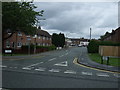
7
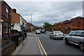
The Church Road and Piele Road junction, Haydock
Image: © Ian Greig
Taken: 18 Jul 2010
0.13 miles
8
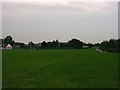
Playing Fields, Haydock
The King George V Playing Fields in Haydock, Merseyside. From SJ55959709 looking S.
Image: © Keith Williamson
Taken: 9 Sep 2005
0.14 miles
9
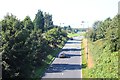
Piele Road, Haydock
Taken from the busy A580 dual carriageway.
Image: © Bob Embleton
Taken: 26 Aug 2013
0.15 miles
10
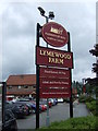
Sign for the Lymewood Farm pub
A Farmhouse Inn.
Image: © JThomas
Taken: 5 Jun 2014
0.16 miles