IMAGES TAKEN NEAR TO
Broadway, ST. HELENS, WA10 5DD

Introduction

This page details the photographs taken nearby to Broadway, WA10 5DD by members of the Geograph project.

The Geograph project started in 2005 with the aim of publishing, organising and preserving representative images for every square kilometre of Great Britain, Ireland and the Isle of Man.

There are currently over 7.5m images from over14,400 individuals and you can help contribute to the project by visiting https://www.geograph.org.uk

Image Map


Images are licensed for reuse under creativecommons.org/licenses/by-sa/2.0
Notes
  • Clicking on the map will re-center to the selected point.
  • The higher the marker number, the further away the image location is from the centre of the postcode.

Image Listing (13 Images Found)

Images are licensed for reuse under creativecommons.org/licenses/by-sa/2.0
Image
Details
Distance
1
Old Signpost Eccleston
Old signpost at the junction of Church Lane, Springfield Lane and Chapel Lane indicating Whiston/Prescot on the B5201 and Rainford. At some time in the past it may have had a third arm to Windle/Wigan.
Image: © Sue Adair Taken: 1 Feb 2020
0.10 miles
2
Signpost junction of Church Lane and Springfield Lane
Image: © Sue Adair Taken: 1 Feb 2020
0.11 miles
3
Eccleston, Christ Church
A view of the west end of the church with its three-stage tower topped by a spire.
Image: © David Dixon Taken: 31 Mar 2019
0.19 miles
4
Christ Church, Eccleston
Christ Church opened its doors on October 10th 1838. Built of rock-faced red sandstone from the nearby quarry at Eccleston Hill, the land was given by Samuel Taylor, a cotton manufacturer who also donated 52 and a half acres of his land to create Taylor Park with its 12 acre lake.
Image: © Sue Adair Taken: 18 Apr 2015
0.19 miles
5
The Churchyard, Eccleston Christ Church
Image: © David Dixon Taken: 31 Mar 2019
0.19 miles
6
Christ Church and Churchyard, Eccleston
Image: © David Dixon Taken: 31 Mar 2019
0.19 miles
7
Christ Church, Eccleston
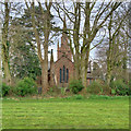
A view, looking across Church Field, towards the eastern side of Christ Church.
Image: © David Dixon Taken: 31 Mar 2019
0.19 miles
8
Old signpost in Mill Brow
Old signpost in the background on the corner of Chapel Lane and Mill Brow adjacent to the early 19th century Old Chapel Cottages.
Image: © Sue Adair Taken: 20 Feb 2020
0.22 miles
9
Christ Church Eccleston, St Helens
Eccleston Parish Church was built in 1836 by the local squire Samuel Taylor and his emblem a griffin is the weather vane and gave the name to the nearby Griffin Inn
Image: © John Stead Taken: 12 May 2006
0.23 miles
10
St.Julie's Roman Catholic Church
On Howards Lane, Eccleston
Image: © JThomas Taken: 13 Sep 2014
0.23 miles