IMAGES TAKEN NEAR TO
Highfield Road, EGHAM, TW20 0TB
Introduction
This page details the photographs taken nearby to Highfield Road, TW20 0TB by members of the Geograph project.
The Geograph project started in 2005 with the aim of publishing, organising and preserving representative images for every square kilometre of Great Britain, Ireland and the Isle of Man.

There are currently over 7.5m images from over14,400 individuals and you can help contribute to the project by visiting https://www.geograph.org.uk
Image Map
Images are licensed for reuse under creativecommons.org/licenses/by-sa/2.0
Notes
- Clicking on the map will re-center to the selected point.
- The higher the marker number, the further away the image location is from the centre of the postcode.
Image Listing (198 Images Found)
Images are licensed for reuse under creativecommons.org/licenses/by-sa/2.0
Image
Details
Distance
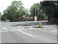
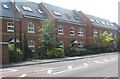
1
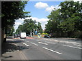
St Jude's Road
Also known as the A 328.
Image: © Basher Eyre
Taken: 14 Jun 2009
0.02 miles
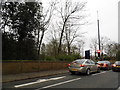
4
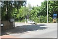
Junction of London Road and St Jude's Road
Image: © Basher Eyre
Taken: 14 Jun 2009
0.04 miles
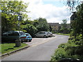
5
Egham Hill at the junction of Bakeham Lane, Englefield Green
Image: © David Howard
Taken: 3 Feb 2013
0.04 miles
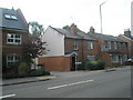
6
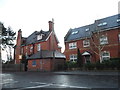
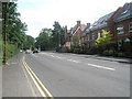
Houses on St Jude's Road, Englefield Green
Image: © David Howard
Taken: 20 Dec 2015
0.05 miles
7
Looking from Bakeham Lane into London Road
Image: © Basher Eyre
Taken: 14 Jun 2009
0.05 miles
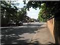
10
Approaching the junction of St Judes Road and Victoria Mews
Image: © Basher Eyre
Taken: 14 Jun 2009
0.05 miles