IMAGES TAKEN NEAR TO
Larksfield, EGHAM, TW20 0RB
Introduction
This page details the photographs taken nearby to Larksfield, TW20 0RB by members of the Geograph project.
The Geograph project started in 2005 with the aim of publishing, organising and preserving representative images for every square kilometre of Great Britain, Ireland and the Isle of Man.

There are currently over 7.5m images from over14,400 individuals and you can help contribute to the project by visiting https://www.geograph.org.uk
Image Map
Images are licensed for reuse under creativecommons.org/licenses/by-sa/2.0
Notes
- Clicking on the map will re-center to the selected point.
- The higher the marker number, the further away the image location is from the centre of the postcode.
Image Listing (85 Images Found)
Images are licensed for reuse under creativecommons.org/licenses/by-sa/2.0
Image
Details
Distance
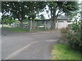
2
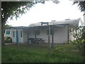
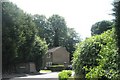
Englefield Green Youth Centre in Corby Drive
Image: © Basher Eyre
Taken: 14 Jun 2009
0.09 miles
5
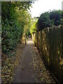
Alleyway between Larksfield and Blays Lane
This alleyway provides a useful pedestrian link between the two estates in Englefield Green divided by Blays Lane. Halfway down there is a connection to the western end of Corby Drive.
Image: © Stuart Keenan
Taken: 1 Aug 2019
0.11 miles
6
Partially hidden postbox in Corby Drive
Image: © Basher Eyre
Taken: 14 Jun 2009
0.11 miles
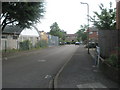
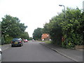
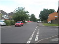
8
Approaching the junction of Corby Close and Corby Drive
Image: © Basher Eyre
Taken: 14 Jun 2009
0.11 miles
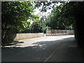
9
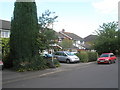
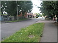
Approaching the junction of Corby Drive and Larksfield
Image: © Basher Eyre
Taken: 14 Jun 2009
0.12 miles