IMAGES TAKEN NEAR TO
Barnway, EGHAM, TW20 0QU
Introduction
This page details the photographs taken nearby to Barnway, TW20 0QU by members of the Geograph project.
The Geograph project started in 2005 with the aim of publishing, organising and preserving representative images for every square kilometre of Great Britain, Ireland and the Isle of Man.

There are currently over 7.5m images from over14,400 individuals and you can help contribute to the project by visiting https://www.geograph.org.uk
Image Map
Images are licensed for reuse under creativecommons.org/licenses/by-sa/2.0
Notes
- Clicking on the map will re-center to the selected point.
- The higher the marker number, the further away the image location is from the centre of the postcode.
Image Listing (192 Images Found)
Images are licensed for reuse under creativecommons.org/licenses/by-sa/2.0
Image
Details
Distance
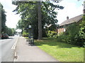
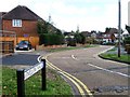
1
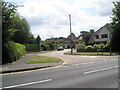
Junction of St Jude's Road and Willow Walk
Image: © Basher Eyre
Taken: 14 Jun 2009
0.09 miles
2
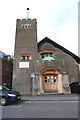
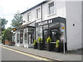
The former Methodist Church, Englefield Green
Now a community centre, thereby disqualifying it from the title of "The Ugliest Church in Christendom"
Image: © John Myers
Taken: 16 Feb 2009
0.09 miles
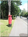
6
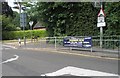
Approaching the junction of Bond Street and Willow Walk
Image: © Basher Eyre
Taken: 14 Jun 2009
0.11 miles
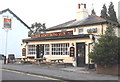
9
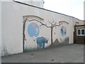
Mural on the Englefield Green Village Centre
Formerly the Methodist church in Victoria Street.
Image: © Basher Eyre
Taken: 14 Jun 2009
0.12 miles
10
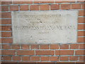
Foundation stone at Englefield Green Social Club (1)
Image: © Basher Eyre
Taken: 14 Jun 2009
0.12 miles