IMAGES TAKEN NEAR TO
Coopers Hill Lane, EGHAM, TW20 0JY
Introduction
This page details the photographs taken nearby to Coopers Hill Lane, TW20 0JY by members of the Geograph project.
The Geograph project started in 2005 with the aim of publishing, organising and preserving representative images for every square kilometre of Great Britain, Ireland and the Isle of Man.

There are currently over 7.5m images from over14,400 individuals and you can help contribute to the project by visiting https://www.geograph.org.uk
Image Map
Images are licensed for reuse under creativecommons.org/licenses/by-sa/2.0
Notes
- Clicking on the map will re-center to the selected point.
- The higher the marker number, the further away the image location is from the centre of the postcode.
Image Listing (18 Images Found)
Images are licensed for reuse under creativecommons.org/licenses/by-sa/2.0
Image
Details
Distance
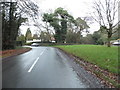
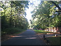
2
Cooper's Hill
Houses on the hill above St Jude's Road in Englefield Green.
Image: © Alan Hunt
Taken: 3 Jun 2013
0.05 miles
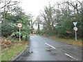
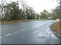
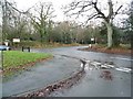
3
Castle Hill Road
Road Junction of Castle Hill Road, Priest's Hill and St Jude's Road at Englefield Green.
Image: © Sean Davis
Taken: 6 Jul 2007
0.05 miles
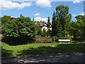
7
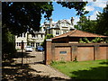
Egham - Large House in Coopers Hill Lane
Image: © James Emmans
Taken: 7 Jun 2017
0.07 miles
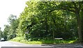
8
Castle Hill Road at the junction of St Jude's Road
At the corner of Ridgemead Road
Image: © David Howard
Taken: 20 Dec 2015
0.07 miles
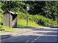
9
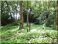
Council Anti Dumping Video Camera
This woodland patch must have been a favourite bumping ground for lazy people and businesses.
Image: © James Emmans
Taken: 7 Jun 2017
0.09 miles