IMAGES TAKEN NEAR TO
Stanwell Place, Park Road, STAINES-UPON-THAMES, TW19 7NR
Introduction
This page details the photographs taken nearby to Stanwell Place, Park Road, TW19 7NR by members of the Geograph project.
The Geograph project started in 2005 with the aim of publishing, organising and preserving representative images for every square kilometre of Great Britain, Ireland and the Isle of Man.

There are currently over 7.5m images from over14,400 individuals and you can help contribute to the project by visiting https://www.geograph.org.uk
Image Map
Images are licensed for reuse under creativecommons.org/licenses/by-sa/2.0
Notes
- Clicking on the map will re-center to the selected point.
- The higher the marker number, the further away the image location is from the centre of the postcode.
Image Listing (28 Images Found)
Images are licensed for reuse under creativecommons.org/licenses/by-sa/2.0
Image
Details
Distance
1
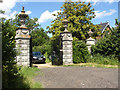
Stanwell Place gates
The gates to this former manor house of Stanwell Place on the bend in Park Road.
This manor house and its associated land was owned by the Gibbons family from 1754 until 1933. The original house was built in the 17th century and rebuilt in the early 19th century.
The estate was sold to Sir John Watson Gibson in 1933. He was a civil engineer who was involved in the design and building of the Mulberry harbours for D-Day. Prior to D-Day he allowed the house to be used for meetings of the allied high command. General Eisenhower and Churchill met here on two occasions in the run up to D-Day.
Part of the land was sold to the Metropolitan Water Board in 1936 which was then used for the construction of the King George VI reservoir.
In 1947 the estate was sold to King Faisal II of Iraq who kept it until his assassination in 1958. The house then became derelict and was demolished in the 1960s when the estate was used for gravel extraction. The gates are the last reminder of this historic site.
Image: © Alan Hunt
Taken: 8 Jun 2014
0.01 miles
2
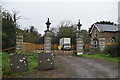
Gate and gate piers, Stanwell Place
Grade II listed. https://historicengland.org.uk/listing/the-list/list-entry/1187058
Image: © N Chadwick
Taken: 23 Nov 2019
0.01 miles
3
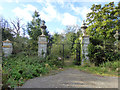
Former gates to Stanwell Place
Grade II listed, but in poor repair. The manor house was demolished in the 1960s, but these gates were used to access a lodge out of sight to the right until recently. Unless access is now effected by a different route, this too seems disused now.
Image: © Robin Webster
Taken: 22 Oct 2017
0.01 miles
4
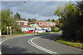
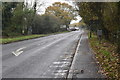
Bend on Park Road, Stanwell
The second half of an S-bend, generally considered to be a result of the diversion of the road around the park of the former Stanwell Place. Its disused gates are off to the left.
Image: © Robin Webster
Taken: 22 Oct 2017
0.02 miles
5
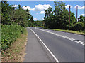
Park Road
Park Road approaching the bend by Stanwell Place gates. The double bend on this section of Park Road was created when the road was diverted around the grounds of Stanwell Place.
Image: © Alan Hunt
Taken: 8 Jun 2014
0.03 miles
8
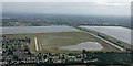
Staines reservious from the air
King George VI reservoir is on the right, the Staines reservoirs are on the left, the northernmost of which was drained earlier in the year to enable maintenance work to be carried out.
Image: © Thomas Nugent
Taken: 3 Aug 2015
0.08 miles
9
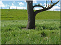
Staines Reservoir enclosure
The grass covered embankment of the Staines Reservoir.
Image: © Alan Hunt
Taken: 8 Jun 2014
0.09 miles