IMAGES TAKEN NEAR TO
De Havilland Way, STAINES-UPON-THAMES, TW19 7NB
Introduction
This page details the photographs taken nearby to De Havilland Way, TW19 7NB by members of the Geograph project.
The Geograph project started in 2005 with the aim of publishing, organising and preserving representative images for every square kilometre of Great Britain, Ireland and the Isle of Man.

There are currently over 7.5m images from over14,400 individuals and you can help contribute to the project by visiting https://www.geograph.org.uk
Image Map (Loading...)


Getting Data...Please wait
Leaflet Map data © OpenStreetMap
Images are licensed for reuse under creativecommons.org/licenses/by-sa/2.0
Notes
- Clicking on the map will re-center to the selected point.
- The higher the marker number, the further away the image location is from the centre of the postcode.
Image Listing (119 Images Found)
Images are licensed for reuse under creativecommons.org/licenses/by-sa/2.0
Image
Details
Distance
1
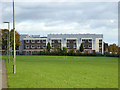
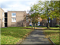
Housing estate, Stanwell
Largely low-rise flats.
Image: © Robin Webster
Taken: 22 Oct 2017
0.07 miles
2
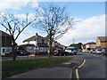
Bedfont Road, Stanwell
From the High Street mini-roundabout junction
Image: © David Howard
Taken: 26 Aug 2013
0.08 miles
3
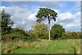
Pine tree, recreation ground, Stanwell
Image: © Robin Webster
Taken: 22 Oct 2017
0.09 miles
4
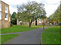
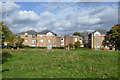
Path towards Whitley Close, Stanwell
In an estate of low-rise flats.
Image: © Robin Webster
Taken: 22 Oct 2017
0.10 miles
6
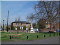
Stanwell
Village green looking north from the church. There is nothing in this photograph to suggest that this scene is less than a kilometre from one of the busiest runways in the world.
Image: © David Squire
Taken: 22 Apr 2006
0.11 miles
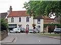
7
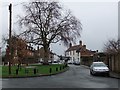
Stanwell village green, looking east
It comes as some surprise to find that this old village centre has survived, so close to Heathrow. The white building on the right at the far end of the green looks a lot like a pub - but if it once was, it is no longer. There are number of old houses around the green, mainly Georgian. The tree is a plane.
For a view of the green from another angle, see: Image
Image: © Stefan Czapski
Taken: 21 Feb 2011
0.11 miles
8
46 to 48 High Street
Grade II listed http://list.english-heritage.org.uk/resultsingle.aspx?uid=1204882
Image: © Oast House Archive
Taken: 6 Aug 2011
0.11 miles
9
Path towards Whitley Close, Stanwell
In an estate of low-rise flats.
Image: © Robin Webster
Taken: 22 Oct 2017
0.12 miles