IMAGES TAKEN NEAR TO
Huntley Close, STAINES-UPON-THAMES, TW19 7DD
Introduction
This page details the photographs taken nearby to Huntley Close, TW19 7DD by members of the Geograph project.
The Geograph project started in 2005 with the aim of publishing, organising and preserving representative images for every square kilometre of Great Britain, Ireland and the Isle of Man.

There are currently over 7.5m images from over14,400 individuals and you can help contribute to the project by visiting https://www.geograph.org.uk
Image Map
Images are licensed for reuse under creativecommons.org/licenses/by-sa/2.0
Notes
- Clicking on the map will re-center to the selected point.
- The higher the marker number, the further away the image location is from the centre of the postcode.
Image Listing (14 Images Found)
Images are licensed for reuse under creativecommons.org/licenses/by-sa/2.0
Image
Details
Distance
1
Stanwell recreation ground
The entrance to the recreation ground from Cordelia Road.
Image: © Alan Hunt
Taken: 24 Jul 2013
0.05 miles
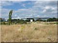
2
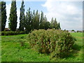
Rough ground, Stanwell
An area of rough ground used for horse grazing to the north of the recreation ground. One of the warehouses near the Heathrow perimeter is in the background.
Image: © Alan Hunt
Taken: 24 Jul 2013
0.14 miles
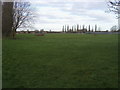
3
Long Lane Recreation Ground
Long Lane Recreation Ground looking across to the football pitch
Image: © Shaun Ferguson
Taken: 15 Feb 2013
0.15 miles
4
Stanwell recreation ground
Sports pitches near the northern edge of the recreation ground.
Image: © Alan Hunt
Taken: 24 Jul 2013
0.15 miles
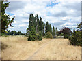
5
Long Lane Recreation Ground
The poplars along the southern edge of the recreation ground in Long Lane make an arresting sight.
Image: © Marathon
Taken: 10 Sep 2014
0.17 miles
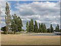
6
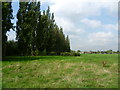
Line of poplars in Long Lane Recreation Ground
The poplars along the southern edge of the recreation ground in Long Lane make an arresting sight.
Image: © Marathon
Taken: 10 Sep 2014
0.17 miles
7
Hadrian Way, Stanwell, TW19
Looking north near the junction with Clare Road. The housing is well set back.
Image: © Andrew Hill
Taken: 16 Jul 2008
0.20 miles
8
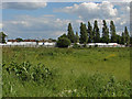
Fields, West Bedfont
Rough pasture north of the large recreation ground off Long Lane.
Image: © Alan Hunt
Taken: 5 Jun 2014
0.21 miles
9
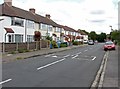
Ravensbourne Avenue, Stanwell
Looking east along Ravensbourne Avenue towards the junction with Long Lane
Image: © Alan Hunt
Taken: 24 Jul 2013
0.21 miles
10
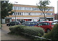
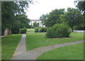
Trident House shop and office block
Clare Road, Stanwell, TW19.
Image: © Andrew Hill
Taken: 16 Jul 2008
0.22 miles