IMAGES TAKEN NEAR TO
Long Lane, STAINES-UPON-THAMES, TW19 7AS
Introduction
This page details the photographs taken nearby to Long Lane, TW19 7AS by members of the Geograph project.
The Geograph project started in 2005 with the aim of publishing, organising and preserving representative images for every square kilometre of Great Britain, Ireland and the Isle of Man.

There are currently over 7.5m images from over14,400 individuals and you can help contribute to the project by visiting https://www.geograph.org.uk
Image Map
Images are licensed for reuse under creativecommons.org/licenses/by-sa/2.0
Notes
- Clicking on the map will re-center to the selected point.
- The higher the marker number, the further away the image location is from the centre of the postcode.
Image Listing (42 Images Found)
Images are licensed for reuse under creativecommons.org/licenses/by-sa/2.0
Image
Details
Distance
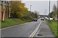
2
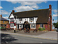
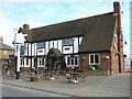
The Three Crowns, Stanwell
The Three Crowns Inn, one of the more distinctive buildings on Long Lane.
Image: © Alan Hunt
Taken: 5 Jun 2014
0.03 miles
6
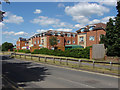
Dudley Place, Stanwell
New build flats along Long Lane in Stanwell.
Image: © Alan Hunt
Taken: 5 Jun 2014
0.08 miles
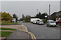
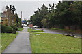
8
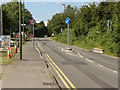
Long Lane
A width resrticting island on Long Lane in West Bedfont
Image: © Alan Hunt
Taken: 5 Jun 2014
0.09 miles
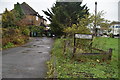
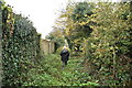
10
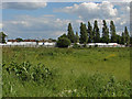
Fields, West Bedfont
Rough pasture north of the large recreation ground off Long Lane.
Image: © Alan Hunt
Taken: 5 Jun 2014
0.12 miles