IMAGES TAKEN NEAR TO
Staines Road, STAINES-UPON-THAMES, TW19 5AH
Introduction
This page details the photographs taken nearby to Staines Road, TW19 5AH by members of the Geograph project.
The Geograph project started in 2005 with the aim of publishing, organising and preserving representative images for every square kilometre of Great Britain, Ireland and the Isle of Man.

There are currently over 7.5m images from over14,400 individuals and you can help contribute to the project by visiting https://www.geograph.org.uk
Image Map
Images are licensed for reuse under creativecommons.org/licenses/by-sa/2.0
Notes
- Clicking on the map will re-center to the selected point.
- The higher the marker number, the further away the image location is from the centre of the postcode.
Image Listing (25 Images Found)
Images are licensed for reuse under creativecommons.org/licenses/by-sa/2.0
Image
Details
Distance
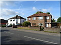
2
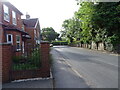
A corner semi-detached
Unusual in that one half is numbered in Mafeking Road and the other in Staines Road, the main road.
Image: © Robin Webster
Taken: 14 Jul 2017
0.03 miles
4
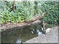
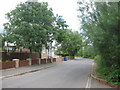
Colne Brook, Hythe End
At the end of Mafeking Road
Image: © David Howard
Taken: 2 Nov 2014
0.07 miles
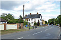
5
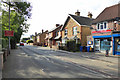
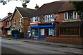
Houses on Staines Road
Hythe End Stores on the right.
Image: © Robin Webster
Taken: 14 Jul 2017
0.07 miles
6
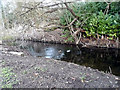
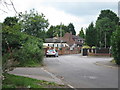
Colne Brook, Hythe End
At the end of Mafeking Road
Image: © David Howard
Taken: 2 Nov 2014
0.07 miles