IMAGES TAKEN NEAR TO
Grosvenor Road, STAINES-UPON-THAMES, TW18 2RW
Introduction
This page details the photographs taken nearby to Grosvenor Road, TW18 2RW by members of the Geograph project.
The Geograph project started in 2005 with the aim of publishing, organising and preserving representative images for every square kilometre of Great Britain, Ireland and the Isle of Man.

There are currently over 7.5m images from over14,400 individuals and you can help contribute to the project by visiting https://www.geograph.org.uk
Image Map
Images are licensed for reuse under creativecommons.org/licenses/by-sa/2.0
Notes
- Clicking on the map will re-center to the selected point.
- The higher the marker number, the further away the image location is from the centre of the postcode.
Image Listing (18 Images Found)
Images are licensed for reuse under creativecommons.org/licenses/by-sa/2.0
Image
Details
Distance
3
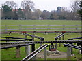
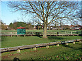
Staines Turntable
"Big" railways do not need turntables any more but the complicated train movements operated by the Staines Society of Model Engineers on this track in Staines Park demand a twelve-road turntable. The tower of the Spelthorne Borough Council Offices in Image can be seen in the background.
Image: © Roger W Haworth
Taken: 14 Mar 2006
0.13 miles
4
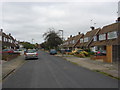
Commercial Road
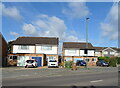
A view along Commercial Road in Knowles Green. Staines Park and the allotments run along the north side of the road.
Image: © Alan Hunt
Taken: 27 Jun 2012
0.16 miles
5
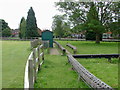
Miniature railway, Staines Park
A simple circuit but with a somewhat novel locomotive preparation yard arrangement off to the left.
Image: © Robin Webster
Taken: 17 Jan 2015
0.18 miles
6
Staines Park
The miniature railway in Staines Park with the houses on Commercial Road in the background.
Image: © Alan Hunt
Taken: 27 Jun 2012
0.19 miles
7
Nursery gardens
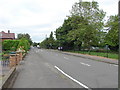
A view along Nursery Gardens, a residential street in Knowle Green
Image: © Alan Hunt
Taken: 27 Jun 2012
0.19 miles
8
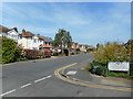
Wheatsheaf Lane
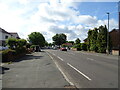
At the junction with Penton Hook Road. Most of this square is 20th century residential streets.
Image: © Des Blenkinsopp
Taken: 10 May 2017
0.19 miles
9
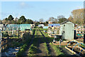
Allotments beside Commercial Road, Staines
Image: © David Martin
Taken: 30 Jan 2023
0.20 miles
10
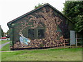
Staines Park
A mural on the rear wall of the Staines Park resource centre, unfortunately disfigured by some add hoc additions.
Image: © Alan Hunt
Taken: 27 Jun 2012
0.20 miles