IMAGES TAKEN NEAR TO
Hurstdene Avenue, STAINES-UPON-THAMES, TW18 1HZ
Introduction
This page details the photographs taken nearby to Hurstdene Avenue, TW18 1HZ by members of the Geograph project.
The Geograph project started in 2005 with the aim of publishing, organising and preserving representative images for every square kilometre of Great Britain, Ireland and the Isle of Man.

There are currently over 7.5m images from over14,400 individuals and you can help contribute to the project by visiting https://www.geograph.org.uk
Image Map
Images are licensed for reuse under creativecommons.org/licenses/by-sa/2.0
Notes
- Clicking on the map will re-center to the selected point.
- The higher the marker number, the further away the image location is from the centre of the postcode.
Image Listing (15 Images Found)
Images are licensed for reuse under creativecommons.org/licenses/by-sa/2.0
Image
Details
Distance
1
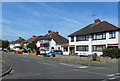
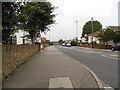
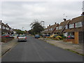
Beechwood Avenue, Staines
Most of this square is 20th century residential streets.
Image: © Des Blenkinsopp
Taken: 10 May 2017
0.02 miles
2
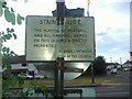
Old Staines council sign, Hurstdene Avenue
Image: © David Howard
Taken: 11 Jul 2010
0.04 miles
3
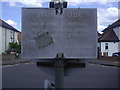
Old Staines council sign, Hurstdene Avenue
This has clearly faced the sun, as a little of the original black lettering can just be seen. The one at the other end of the green is still as original.
Image: © David Howard
Taken: 11 Jul 2010
0.04 miles
4
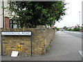
Worple Road from the corner of Commercial Road
Image: © David Howard
Taken: 2 Sep 2012
0.05 miles
7
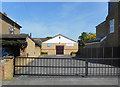
Jehovah's Witness Hall, Chestnut Grove
Image: © Des Blenkinsopp
Taken: 10 May 2017
0.19 miles
8
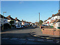
Houses on Ash Grove
Looking from Hazel Grove.
Image: © Robin Webster
Taken: 17 Jan 2015
0.19 miles
9
Nursery gardens
A view along Nursery Gardens, a residential street in Knowle Green
Image: © Alan Hunt
Taken: 27 Jun 2012
0.19 miles
10
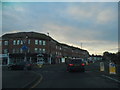
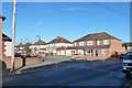
Shops on Kingston Road, Staines
At the junction with Worple Road
Image: © David Howard
Taken: 14 Dec 2014
0.23 miles