IMAGES TAKEN NEAR TO
Cherry Way, SHEPPERTON, TW17 8QQ
Introduction
This page details the photographs taken nearby to Cherry Way, TW17 8QQ by members of the Geograph project.
The Geograph project started in 2005 with the aim of publishing, organising and preserving representative images for every square kilometre of Great Britain, Ireland and the Isle of Man.

There are currently over 7.5m images from over14,400 individuals and you can help contribute to the project by visiting https://www.geograph.org.uk
Image Map
Images are licensed for reuse under creativecommons.org/licenses/by-sa/2.0
Notes
- Clicking on the map will re-center to the selected point.
- The higher the marker number, the further away the image location is from the centre of the postcode.
Image Listing (40 Images Found)
Images are licensed for reuse under creativecommons.org/licenses/by-sa/2.0
Image
Details
Distance
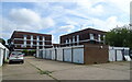
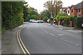
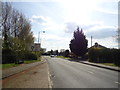
1
Roundabout on Gaston Bridge Road and Upper Halliford Road
Image: © David Howard
Taken: 2 Sep 2012
0.06 miles
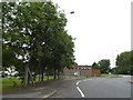
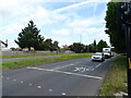
2
Upper Halliford Road
Looking south along Upper Halliford Road as it enters the village from the bypass roundabout.
Image: © Alan Hunt
Taken: 24 Sep 2015
0.08 miles
3
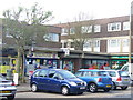
Upper Halliford
Village centre with flats above the street level shops and ample on street parking.
Image: © Colin Smith
Taken: 14 Dec 2011
0.10 miles
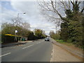
8
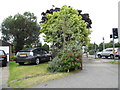
Front garden on the corner of Charlton Lane
Image: © David Howard
Taken: 2 Sep 2012
0.12 miles
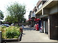
9
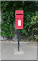
Elizabeth II postbox on Charlton Lane, Upper Halliford
Postbox No. TW17 300.
Image: © JThomas
Taken: 27 May 2022
0.12 miles