IMAGES TAKEN NEAR TO
Hetherington Road, SHEPPERTON, TW17 0SW
Introduction
This page details the photographs taken nearby to Hetherington Road, TW17 0SW by members of the Geograph project.
The Geograph project started in 2005 with the aim of publishing, organising and preserving representative images for every square kilometre of Great Britain, Ireland and the Isle of Man.

There are currently over 7.5m images from over14,400 individuals and you can help contribute to the project by visiting https://www.geograph.org.uk
Image Map
Images are licensed for reuse under creativecommons.org/licenses/by-sa/2.0
Notes
- Clicking on the map will re-center to the selected point.
- The higher the marker number, the further away the image location is from the centre of the postcode.
Image Listing (15 Images Found)
Images are licensed for reuse under creativecommons.org/licenses/by-sa/2.0
Image
Details
Distance
1
Houses on Almond Close from Charlton Road
Image: © David Howard
Taken: 26 Aug 2013
0.06 miles
3
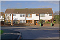
Houses in Charlton
A modern terrace of houses in Charlton Road opposite Hetherington Road
Image: © Ian Capper
Taken: 10 Nov 2010
0.08 miles
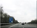
5
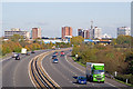
Towards Sunbury Cross
The offices of Sunbury Cross, seen above the M3 motorway, viewed from Charlton Lane overbridge.
Image: © Ian Capper
Taken: 10 Nov 2010
0.19 miles
6
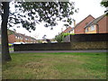
Tip Boundary
Public footpath passes rear of the tip.
Image: © James Emmans
Taken: 27 Jun 2015
0.21 miles
8
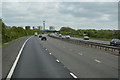
Scrubland, Upper Halliford
The large area of scrub to the southeast of the M3 between junction 1 and 2 taken from the footpath from Upper Halliford to Charlton Village.
Image: © Alan Hunt
Taken: 24 Sep 2015
0.22 miles
9
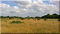
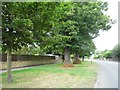
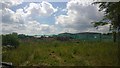
Open Land
Field left to nature between the M3 and railway line.
Image: © James Emmans
Taken: 27 Jun 2015
0.23 miles
10
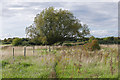
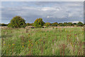
Scrubland near Upper Halliford
A willow in the large area of rough pasture and scrub on the footpath from Upper Halliford to Charlton.
Image: © Alan Hunt
Taken: 24 Sep 2015
0.23 miles