
IMAGES TAKEN NEAR TO
Stanwell Road, ASHFORD, TW15 3QH
Introduction
This page details the photographs taken nearby to Stanwell Road, TW15 3QH by members of the Geograph project.
The Geograph project started in 2005 with the aim of publishing, organising and preserving representative images for every square kilometre of Great Britain, Ireland and the Isle of Man.

There are currently over 7.5m images from over14,400 individuals and you can help contribute to the project by visiting https://www.geograph.org.uk
Image Map
Images are licensed for reuse under creativecommons.org/licenses/by-sa/2.0
Notes
- Clicking on the map will re-center to the selected point.
- The higher the marker number, the further away the image location is from the centre of the postcode.
Image Listing (15 Images Found)
Images are licensed for reuse under creativecommons.org/licenses/by-sa/2.0
Image
Details
Distance

2
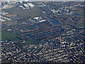
Bedfont Lakes Country park from the air
Part of Heathrow Airport can be seen in the top left corner.
Friend of Bedfont Lakes web site: https://www.bedfontlakes.co.uk/ .
Image: © Thomas Nugent
Taken: 19 Jan 2020
0.06 miles
3
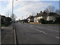
Woodthorpe Road
Woodthorpe Road passing West Close
Image: © Shaun Ferguson
Taken: 20 Feb 2013
0.18 miles
4
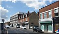
Woodthorpe Road, Ashford
An old shop terrace in between more recent developments.
Image: © Des Blenkinsopp
Taken: 15 Aug 2023
0.20 miles
5
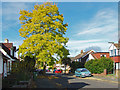
False acacia, Tennyson Road
A fine false acacia in Tennyson Road, Ashford.
Image: © Alan Hunt
Taken: 20 Oct 2014
0.21 miles
6
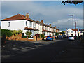
Fairholme Road, Ashford
The 1930s housing estates to the west of Ashford town centre.
Image: © Alan Hunt
Taken: 20 Oct 2014
0.22 miles
7
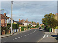
Stanwell Road, Ashford
Looking north along Stanwell Road, the main road through the 1930s housing estates to the west of the town centre.
Image: © Alan Hunt
Taken: 20 Oct 2014
0.22 miles
8
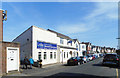
Lodge, Masons
Stonemasons, Clarendon Road, Ashford.
Image: © Des Blenkinsopp
Taken: 10 May 2017
0.22 miles
9
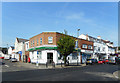
Lloyds Bank on the Corner
Woodthorpe Road, Ashford.
Image: © Des Blenkinsopp
Taken: 10 May 2017
0.22 miles
10
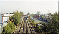
Ashford (Middlesex) station, 1992
View eastward from the Stanwell Road bridge, towards London: ex-LSWR Waterloo - Staines - Reading secondary main line. (Note that the station is still called 'Middlesex' although the County ceased to exist nearly 40 years ago and this now Surrey).
Image: © Ben Brooksbank
Taken: 23 Jun 1992
0.23 miles