IMAGES TAKEN NEAR TO
Queens Walk, ASHFORD, TW15 3JA
Introduction
This page details the photographs taken nearby to Queens Walk, TW15 3JA by members of the Geograph project.
The Geograph project started in 2005 with the aim of publishing, organising and preserving representative images for every square kilometre of Great Britain, Ireland and the Isle of Man.

There are currently over 7.5m images from over14,400 individuals and you can help contribute to the project by visiting https://www.geograph.org.uk
Image Map
Images are licensed for reuse under creativecommons.org/licenses/by-sa/2.0
Notes
- Clicking on the map will re-center to the selected point.
- The higher the marker number, the further away the image location is from the centre of the postcode.
Image Listing (20 Images Found)
Images are licensed for reuse under creativecommons.org/licenses/by-sa/2.0
Image
Details
Distance
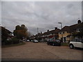
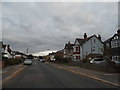
2
Towards Ashford Station
This footbridge is roughly midway between Ashford and Staines. Looking here towards Ashford (and Waterloo).
Image: © David Squire
Taken: 22 Apr 2006
0.07 miles
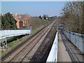
6
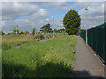
Footpath, Ashford
The footpath that runs from Woodthorpe Road over the railway and thence to Shortwood Common.
Image: © Alan Hunt
Taken: 6 Aug 2012
0.11 miles
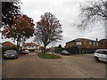
7
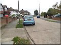
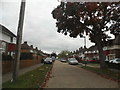
Woodthorpe Road
Woodthorpe Road passing West Close
Image: © Shaun Ferguson
Taken: 20 Feb 2013
0.12 miles
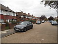
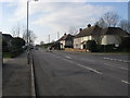
10
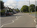
Woodthorpe Road
A view along Woodthorpe Road in Ashford. The entrance to Bronzefield prison is marked by the blue sign on the right.
Image: © Alan Hunt
Taken: 6 Aug 2012
0.14 miles