
IMAGES TAKEN NEAR TO
Chop Gate, MIDDLESBROUGH, TS9 7LJ
Introduction
This page details the photographs taken nearby to TS9 7LJ by members of the Geograph project.
The Geograph project started in 2005 with the aim of publishing, organising and preserving representative images for every square kilometre of Great Britain, Ireland and the Isle of Man.

There are currently over 7.5m images from over14,400 individuals and you can help contribute to the project by visiting https://www.geograph.org.uk
Image Map
Images are licensed for reuse under creativecommons.org/licenses/by-sa/2.0
Notes
- Clicking on the map will re-center to the selected point.
- The higher the marker number, the further away the image location is from the centre of the postcode.
Image Listing (13 Images Found)
Images are licensed for reuse under creativecommons.org/licenses/by-sa/2.0
Image
Details
Distance

2
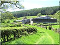
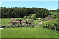
Approaching Helm House farm
A collection of utilitarian barns and outhouses with the more traditional farmhouse and barns beyond. Taken looking along the bridleway that runs south from Fangdale Beck.
Image: © Gordon Hatton
Taken: 24 May 2019
0.05 miles
4
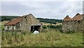
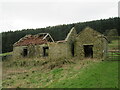
Old barns near Helm House
Two old stone barns south of the main farm buildings. Both are in an advanced state of decay.
Image: © Gordon Hatton
Taken: 24 May 2019
0.09 miles
5
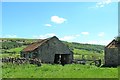
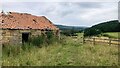
Old Barn at Helm House
Laverock Hall and Farm can be seen to the left, that is the way we are going, and over the top.
Image: © Martin Dawes
Taken: 15 Jul 2012
0.09 miles
7
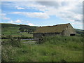
Ruined barn near Malkin Bower
The condition has deteriorated since June 2021.
https://www.geograph.org.uk/photo/6869326
Image: © T Eyre
Taken: 21 Mar 2023
0.10 miles
9
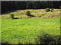
Field with bushes
The field lies below Helm House Wood the trees of which are seen at the top of the image. Helm House Farm lies to the north, outside the view and to the right.
Image: © Trevor Littlewood
Taken: 7 Sep 2014
0.15 miles
10
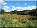
Rough vegetation beside River Seph
The River Seph flows through Bilsdale; here it lies to the right of the image adjacent to roughly vegetated land which is presumably too marginal to be of agricultural use.
Image: © Trevor Littlewood
Taken: 7 Sep 2014
0.18 miles