IMAGES TAKEN NEAR TO
Chop Gate, MIDDLESBROUGH, TS9 7LD
Introduction
This page details the photographs taken nearby to TS9 7LD by members of the Geograph project.
The Geograph project started in 2005 with the aim of publishing, organising and preserving representative images for every square kilometre of Great Britain, Ireland and the Isle of Man.

There are currently over 7.5m images from over14,400 individuals and you can help contribute to the project by visiting https://www.geograph.org.uk
Image Map
Images are licensed for reuse under creativecommons.org/licenses/by-sa/2.0
Notes
- Clicking on the map will re-center to the selected point.
- The higher the marker number, the further away the image location is from the centre of the postcode.
Image Listing (14 Images Found)
Images are licensed for reuse under creativecommons.org/licenses/by-sa/2.0
Image
Details
Distance
1
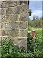
Low Mill, Bilsdale
Old corn mill standing alongside fast flowing mill race - with benchmark on 2nd course of stones, 1ft above ground level. Showing 435ft above sea level on 1910 OS map.
Image: © Mel Towler
Taken: 19 May 2021
0.05 miles
2
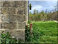
Bilsdale, old Corn Mill at Low Mill
Benchmark on RHS, 2nd course of stones.
Image: © Mel Towler
Taken: 19 May 2021
0.05 miles
3
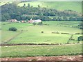
Low Mill, Bilsdale
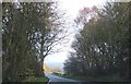
The farm Low Mill in Bilsdale with the B1257 behind. Taken from Limestone Ridge (SE562952).
Bilsdale was named after William, Duke of Normanby. He noted in the Domesday Book that it was devoid of any habitation.
Reference:
Parva Broctune
By June Hodgson (2005)
Image: © Mick Garratt
Taken: 16 Sep 2005
0.07 miles
5
Old guidestone
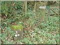
This moss-covered stone on the east side of the B1257 near the signpost 'BRIDLEWAY/BRANSDALE is engraved on 3 sides. Left face-STOKESLEY. Front-HELMSLEY. Right face-KIRBY/MOOR/SIDE. It has a pin and arrow on the top. It may date from the late 18C or early 19C and indicates the packhorse route across the moors to Bransdale.
Image: © Chris Minto
Taken: 17 Oct 2023
0.10 miles
6
Old guidestone
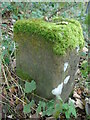
The Stokesley face with the white lichens on the Helmsley face on the guidestone at the start of the track over the moors to Bransdale.
Image: © Chris Minto
Taken: 17 Oct 2023
0.10 miles
7
Old guidestone
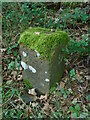
The front face, Helmsley, with the lichens and the Kirbymoorside face adjacent to the start of the bridleway. Kirbymoorside is an old spelling seen on many ancient guidestones and milestones. Now spelt Kirkbymoorside on modern maps.
Image: © Chris Minto
Taken: 17 Oct 2023
0.10 miles
8
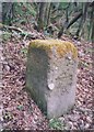
Old Guide Stone by the B1257, Bilsdale Midcable parish
Guide Stone by the B1257, in parish of Bilsdale Midcable (Hambleton District), Bilsdale, near Low Mill, at start of Bridleway to Bransdale (sign).
Surveyed
Milestone Society National ID: YN_XBILb
Image: © Milestone Society
Taken: Unknown
0.10 miles
9
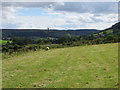
Field Path from Stable Holme to Low Mill
Looking southward.
Image: © Peter Wood
Taken: 26 Aug 2015
0.16 miles