
IMAGES TAKEN NEAR TO
Chop Gate, MIDDLESBROUGH, TS9 7JH
Introduction
This page details the photographs taken nearby to TS9 7JH by members of the Geograph project.
The Geograph project started in 2005 with the aim of publishing, organising and preserving representative images for every square kilometre of Great Britain, Ireland and the Isle of Man.

There are currently over 7.5m images from over14,400 individuals and you can help contribute to the project by visiting https://www.geograph.org.uk
Image Map
Images are licensed for reuse under creativecommons.org/licenses/by-sa/2.0
Notes
- Clicking on the map will re-center to the selected point.
- The higher the marker number, the further away the image location is from the centre of the postcode.
Image Listing (8 Images Found)
Images are licensed for reuse under creativecommons.org/licenses/by-sa/2.0
Image
Details
Distance
1
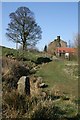
Approaching Thwaites House
On the Public Footpath from Staindale farm.
Image: © Mick Garratt
Taken: 25 Mar 2007
0.03 miles
2
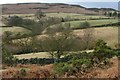
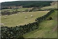
Thwaites House
From the east. Carlton Bank behind.
Image: © Mick Garratt
Taken: 6 Mar 2008
0.03 miles
3
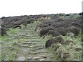
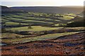
Path restoration, Carlton Bank.
In the 1970's The Lyke Wake Walk a 44 mile crossing of the moors was a very popular outing. Coupled with the nearby road at Lord's Stones and the soft sandstones and soils, this hillside came under some visitor pressure. It was a candidate for the most eroded path in England. Recently restoration work has repaired much of the damage, and although the new paths are not to everyone's taste, they are weathering in and allow a visit to Carlton Bank without wrecking the place.
Image: © Richard Webb
Taken: 14 Apr 2004
0.06 miles
4
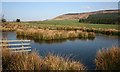
Unmapped Pond, Near Thwaites House
It must be a fairly new pond complete with an island wildfowl refuge but on this occasion was only occupied by a pair of Mallards. Cringle Moor is in the distance and Harry Wath Wood to the right.
Image: © Mick Garratt
Taken: 25 Mar 2007
0.12 miles
7
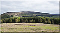
Coniferous plantation close to Lordstones
The small coniferous plantation is edged at least on the near side with deciduous trees. Lordstones, a country park, is off to the left, out of the image.
Cringle Moor is the distant upland.
Image: © Trevor Littlewood
Taken: 10 May 2021
0.23 miles
8
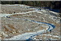
One of the joys of being out and about
Fresh snow, clear skies, calm. An interesting climb up Carlton Bank. Proving too icy for the car so a tricky reverse. But it was worth it in the end.
“Keep close to Nature’s heart… and break clear away, once in awhile, and climb a mountain or spend a week in the woods. Wash your spirit clean.” – John Muir
From my photo-diary 30 January 2019 http://www.fhithich.uk/?p=20734
Image: © Mick Garratt
Taken: 30 Jan 2019
0.24 miles