
IMAGES TAKEN NEAR TO
Mill Lane, MIDDLESBROUGH, TS9 7BL
Introduction
This page details the photographs taken nearby to Mill Lane, TS9 7BL by members of the Geograph project.
The Geograph project started in 2005 with the aim of publishing, organising and preserving representative images for every square kilometre of Great Britain, Ireland and the Isle of Man.

There are currently over 7.5m images from over14,400 individuals and you can help contribute to the project by visiting https://www.geograph.org.uk
Image Map
Images are licensed for reuse under creativecommons.org/licenses/by-sa/2.0
Notes
- Clicking on the map will re-center to the selected point.
- The higher the marker number, the further away the image location is from the centre of the postcode.
Image Listing (24 Images Found)
Images are licensed for reuse under creativecommons.org/licenses/by-sa/2.0
Image
Details
Distance
1
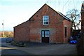
Faceby Village Hall
Hidden away down a narrow lane just along Mill Lane from the Sutton Arms
Image: © Paul Buckingham
Taken: 20 Feb 2010
0.05 miles
2
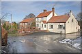
Sutton Arms
I had forgotten I had taken an almost identical photo four and a half years ago. See Image Nothing much has changed.
Image: © Mick Garratt
Taken: 11 Feb 2010
0.11 miles
3
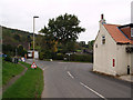
Road junction at Faceby
Looking along Mill Lane with Bank Lane off on the left.
The postbox is set into the wall of the Sutton Arms public house.
Image: © Stephen McCulloch
Taken: 25 Oct 2007
0.13 miles
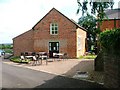
5
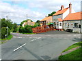
Faceby, Village Centre with Road Junction, Cottages and .... er, a pub.
The name Faceby is of Scandinavian origin and means "Fatty's Farm".
Image: © Mick Garratt
Taken: 20 Aug 2005
0.14 miles
6
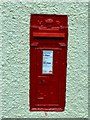
Postbox on the Sutton Arms
Victorian wall post box.
Image: © John M
Taken: 13 Aug 2013
0.14 miles
7
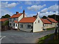
Su ton Arms
There is a Victorian postbox in the gable wall.
Image: © John M
Taken: 13 Aug 2013
0.14 miles
8
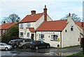
Sutton Arms Faceby
Close to Sunday lunchtime and the parking area is filling before stomachs are filled in the restaurant. On the day, the pub was either called the 'Sutton Am' or the 'Sutton Rs' as two letters were missing and I can't recall which.
Image: © Gordon Hatton
Taken: 20 Dec 2020
0.15 miles
9
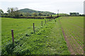
Footpath to Faceby
Passing a mixture of arable and grazing land, with Whorl Hill prominent ahead.
Image: © Bill Boaden
Taken: 21 May 2015
0.17 miles
10

Dry ford
The depth marker suggests it must rise quite high at times. The trickle flowing though a pipe once turned a water mill at Faceby.
Image: © John M
Taken: 13 Aug 2013
0.17 miles