
IMAGES TAKEN NEAR TO
Newton Under Roseberry, MIDDLESBROUGH, TS9 6QP
Introduction
This page details the photographs taken nearby to TS9 6QP by members of the Geograph project.
The Geograph project started in 2005 with the aim of publishing, organising and preserving representative images for every square kilometre of Great Britain, Ireland and the Isle of Man.

There are currently over 7.5m images from over14,400 individuals and you can help contribute to the project by visiting https://www.geograph.org.uk
Image Map
Images are licensed for reuse under creativecommons.org/licenses/by-sa/2.0
Notes
- Clicking on the map will re-center to the selected point.
- The higher the marker number, the further away the image location is from the centre of the postcode.
Image Listing (8 Images Found)
Images are licensed for reuse under creativecommons.org/licenses/by-sa/2.0
Image
Details
Distance
4
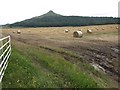
Field next to A173, looking towards Roseberry Topping
Image: © David Gearing
Taken: 25 Jul 2011
0.16 miles
5
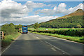
A173 passes Roseberry Topping
The striking outlier of the North Yorkshire Moors peaks at 320 m.
Image: © Robin Webster
Taken: 7 Oct 2011
0.16 miles
6
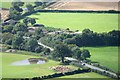
A173 Railway Bridge
Taken from the summit of Roseberry. The bridge is hidden by the trees but the tracks are just visible on the left. The building extreme left is the Image] and the track in Stephen's photo Image] is heading off out of the top. Almost a reciprocal shot. The fields are very wet due to overnight heavy rain.
Image: © Mick Garratt
Taken: 6 Sep 2008
0.18 miles
7
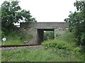
A173 road bridge over the railway north of Great Ayton
Image: © John Slater
Taken: 3 Jul 2016
0.24 miles
8
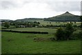
Fields North of Langbaurgh Ridge
View from the top of the ridge. The old tramway depot can be seen left of centre with Roseberry Topping in the distance.
Image: © Mick Garratt
Taken: 21 Jun 2007
0.24 miles