IMAGES TAKEN NEAR TO
Wheatlands, MIDDLESBROUGH, TS9 6EF
Introduction
This page details the photographs taken nearby to Wheatlands, TS9 6EF by members of the Geograph project.
The Geograph project started in 2005 with the aim of publishing, organising and preserving representative images for every square kilometre of Great Britain, Ireland and the Isle of Man.

There are currently over 7.5m images from over14,400 individuals and you can help contribute to the project by visiting https://www.geograph.org.uk
Image Map
Images are licensed for reuse under creativecommons.org/licenses/by-sa/2.0
Notes
- Clicking on the map will re-center to the selected point.
- The higher the marker number, the further away the image location is from the centre of the postcode.
Image Listing (20 Images Found)
Images are licensed for reuse under creativecommons.org/licenses/by-sa/2.0
Image
Details
Distance
1
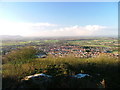
Great Ayton
Taken from Cliff Ridge and viewed south west. The northernmost half of the village (to the right) is the part in the subject square. The houses just above the trees were built in the seventies. To the left of them can be seen the local primary school.
Image: © Mick Garratt
Taken: 19 Dec 2004
0.03 miles
2

22? Halo
Morning exercise over and I was mellowing out in the garden after lunch when I noticed this halo around the sun. It’s a sundog I thought remembering something I read somewhere. Why is it I don’t know what I was doing two days ago yet an insignificant fact from twenty years ago pops into mind? Anyway my memory proved wrong as it turned out not to be a sundog but a similar solar phenomena called a “22º Halo”, a rather boring name. 22º Halos are formed by the refraction of sunlight in ice crystals in clouds in the upper atmosphere. The ice crystals are found in cirrus or cirrostratus clouds and are hexagonal in shape. Cirrus and cirrostratus clouds may foretell the approach of a warm front and a deterioration of the weather.
Sundogs are formed by the same mechanism but are concentrated areas of light either side of the sun (at 3 and 9 o’clock positions). They are rarer than 22º Halos which are actually quite common but rarely noticed.
From my blog https://fhithich.wordpress.com/2015/05/30/22o-halo/
Image: © Mick Garratt
Taken: 30 May 2015
0.03 miles
3
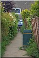
Dog Waste Bin
This small section of tarmacked path allow access from Roseberry Crescent to the fields and Newton Woods and is notorious for dog shit in spite of there being a dog waste bin present. It is particularly bad in winter when the fields are muddy and owners cannot be bothered to get their shoes dirty.
Image: © Mick Garratt
Taken: 29 Jun 2008
0.08 miles
4
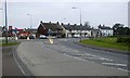
A173 Newton Road
The mini island is a recent innovation but there are discussions as to whether it should be removed and the T junction restored.
Image: © Mick Garratt
Taken: 15 Oct 2007
0.08 miles
5

Field Near Cliff Cottage
View south east from the Public Footpath which runs in front of the cottage.
Image: © Mick Garratt
Taken: 28 Dec 2005
0.10 miles
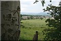
7

A173 leaves Great Ayton
Fields on the left, the last of the housing on the right.
Image: © Robin Webster
Taken: 7 Oct 2011
0.12 miles
8

Dandelions, Near Cliffe House
Looking south west onto the backs of the houses on Roseberry Crescent.
Image: © Mick Garratt
Taken: 23 May 2010
0.14 miles
9

Sunrise Over Capt. Cook?s
Inside all day gazing longingly
over the sunny snow-covered Cleveland Hills.
So an early run with the dog,
no headtorch needed,
and a lovely red sky to finish.
From my photo-diary 3rd February 2019 http://www.fhithich.uk/?p=20747
Image: © Mick Garratt
Taken: 3 Feb 2019
0.15 miles