
IMAGES TAKEN NEAR TO
Great Ayton, MIDDLESBROUGH, TS9 6BT
Introduction
This page details the photographs taken nearby to TS9 6BT by members of the Geograph project.
The Geograph project started in 2005 with the aim of publishing, organising and preserving representative images for every square kilometre of Great Britain, Ireland and the Isle of Man.

There are currently over 7.5m images from over14,400 individuals and you can help contribute to the project by visiting https://www.geograph.org.uk
Image Map
Images are licensed for reuse under creativecommons.org/licenses/by-sa/2.0
Notes
- Clicking on the map will re-center to the selected point.
- The higher the marker number, the further away the image location is from the centre of the postcode.
Image Listing (16 Images Found)
Images are licensed for reuse under creativecommons.org/licenses/by-sa/2.0
Image
Details
Distance
1
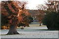
Cleveland Lodge
Built by Thomas Richardson, a London financier and one of the founders of the North of England Agricultural School for Girls and Boys, later to become the Friends School. Once the residence of the Fry family, famous for their chocolet.
Image: © Mick Garratt
Taken: 3 Feb 2007
0.02 miles
2

Footpath to Great Ayton
This photograph shows a view of the public footpath that runs between the village of Great Ayton and Cliff Ridge Wood. The picture was taken looking in a south-westerly direction towards Great Ayton.
Image: © Philip Barker
Taken: 7 Feb 2010
0.06 miles
4
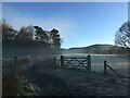
Captain Cook?s Monument from Great Ayton.
A distant view of Captain Cook’s Monument from the footpath to Cliff Ridge Wood.
Image: © John Peacock
Taken: 17 Dec 2021
0.09 miles
5
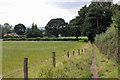
Footpath into Great Ayton
The path runs quite straight, southwest into the village, passing through a series of kissing gates before emerging onto the road.
Image: © Peter Church
Taken: 15 Aug 2008
0.10 miles
7

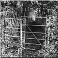
Footpath to Rye Hill
This footpath runs in a north-easterly direction from Great Ayton to Rye Hill. It crosses the railway track near Rye Hill Farm and then climbs up to Cliff Ridge Wood - which can be seen on the horizon.
Image: © Philip Barker
Taken: 6 Dec 2009
0.17 miles
8
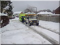
Roseberry Road
The Cleveland Search and Rescue Team come to the rescue of an ambulance stuck in the snow.
Image: © Mick Garratt
Taken: 1 Dec 2010
0.18 miles
9
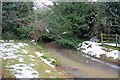
Skitterbeck
From here the stream is culverted under the village to outflow into the River Leven at Suggits.
Image: © Mick Garratt
Taken: 1 Jan 2011
0.20 miles
10
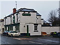
The Newton Rose
Formerly The Tilesheds because on the nearby brick and tile works. It has stood empty for about four years now (at 2014) and one of only three pubs in the village. Rumour has it that the plan is to convert into residential accommodation.
Image: © Mick Garratt
Taken: 11 Dec 2014
0.22 miles