IMAGES TAKEN NEAR TO
Folkestone Close, MIDDLESBROUGH, TS8 9LF
Introduction
This page details the photographs taken nearby to Folkestone Close, TS8 9LF by members of the Geograph project.
The Geograph project started in 2005 with the aim of publishing, organising and preserving representative images for every square kilometre of Great Britain, Ireland and the Isle of Man.

There are currently over 7.5m images from over14,400 individuals and you can help contribute to the project by visiting https://www.geograph.org.uk
Image Map
Images are licensed for reuse under creativecommons.org/licenses/by-sa/2.0
Notes
- Clicking on the map will re-center to the selected point.
- The higher the marker number, the further away the image location is from the centre of the postcode.
Image Listing (4 Images Found)
Images are licensed for reuse under creativecommons.org/licenses/by-sa/2.0
Image
Details
Distance
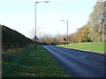
2
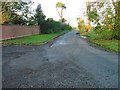
Old Hemlington Road
At the junction to Stainton Grange. This bit of road has now been bypassed and is only now used for access.
Image: © Mick Garratt
Taken: 7 Nov 2005
0.19 miles