IMAGES TAKEN NEAR TO
Attingham Close, MIDDLESBROUGH, TS8 9HS
Introduction
This page details the photographs taken nearby to Attingham Close, TS8 9HS by members of the Geograph project.
The Geograph project started in 2005 with the aim of publishing, organising and preserving representative images for every square kilometre of Great Britain, Ireland and the Isle of Man.

There are currently over 7.5m images from over14,400 individuals and you can help contribute to the project by visiting https://www.geograph.org.uk
Image Map (Loading...)


Getting Data...Please wait
Leaflet Map data © OpenStreetMap
Images are licensed for reuse under creativecommons.org/licenses/by-sa/2.0
Notes
- Clicking on the map will re-center to the selected point.
- The higher the marker number, the further away the image location is from the centre of the postcode.
Image Listing (7 Images Found)
Images are licensed for reuse under creativecommons.org/licenses/by-sa/2.0
Image
Details
Distance
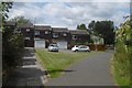
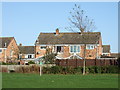
1
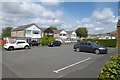
Axminster Road
Hemlington - a path passes the end of a cul de sac.
Image: © Richard Webb
Taken: 10 Aug 2016
0.10 miles
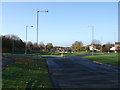
5
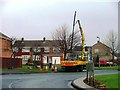
Road Lights Repairs, Cass House Island
Sunday morning and it's no rest for the maintenance dept. who are removing this road lamp which someone decided to prang overnight.
Image: © Mick Garratt
Taken: 15 Jan 2006
0.16 miles
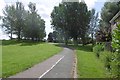
6
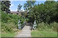
Bridge, Hemlington
A bridge over the Blue Bell Beck in Hemlington.
Image: © Richard Webb
Taken: 10 Aug 2016
0.19 miles